If you've seen the heading of this blog, you've seen me on the Raven's Horn. Now here's the story of my most difficult hike.
The Raven's Horn is a rock outcropping on the east side of Pine Creek Gorge, just south of the town of Slate Run. The horn is reached by the Golden Eagle Trail, a nearly ten mile hike up and through the mountains that has been called the best dayhike in Pennsylvania by at least one authority. Most hikers complete the trail with the Raven's Horn as the end, leaving only a couple of miles back to the trailhead.
This striking image was photographed by Chris, one of my two guides for the hike. Chris and his friend Lee met me on the last Saturday of my vacation to take me up to see the most impressive landscape I've ever viewed.
Our meeting is another blessing of the Internet. I first learned of the Raven's Horn on a Facebook group for hiking and backpacking in Pennsylvania. While I am a novice hiker, I read and post there so I can find places to hike and learn more about how to do it safely and successfully. Chris posted a photo of himself atop the Raven's Horn, I commented that I'd like to do it someday, and I received an offer to be guided up the mountain. A few messages were exchanged and a date set of August 3. The hike would be on the last weekend of my vacation, and I'd stop in the gorge to hike it before heading for home.
We met at the Clark Farm trailhead on the Pine Creek Rail Trail at a quarter to nine. After introductions were exchanged and we gathered our gear we crammed into Chris' car to drive to the trailhead. While our hike was going to use the Golden Eagle Trail, we were starting from the old trailhead. When the Pine Creek Rail Trail was opened by the PA Department of Conservation and Natural Resources, the trailhead was relocated to opposite the new parking area at Clark Farm. The old trailhead is a little more than a mile away, south on Route 414 next to Wolf Run.

It was a foggy morning, as usual, on Pine Creek, and we set off with the hopes the sun would soon burn the clouds off. I immediately ran into problems crossing the rail trail. It was elevated to keep it from getting swamped in a rain, and I had to climb down into the gutter and then back up. I walked a few feet to find a gentler angle and crossed. Meanwhile the thoughts in my mind were "I hope I don't have to do things like this the whole trip" and "I can't imagine what Chris and Lee think of my hiking abilities now."
Within fifty yards of the entrance to the trail there was a partial washout about five feet across. With some direction from my guides I got across. Then the narrow trail began to climb as it entered the series of switchbacks. Some of them were very steep, and I needed to pause to find my footing. I had borrowed Chris' Leki hiking poles, and was learning to use them. But gear doesn't make the hiker.
I quickly realized I was in over my head hiking this trail. I thought having hiked Pole Steeple and Hawk Mountain that I'd be able to take on the Raven's Horn hike without additional difficulty. I was wrong. This was testing me as I've never been tested. Chris kept telling me "You are stronger than you realize", but I was too busy trying to find a way up the slope to hear him.

I was even too busy to photograph the climb, or even notice how high we'd gone. I spent most of the hike looking at my feet and the ground ahead of me. Fortunately Lee was busy taking photos, and I should be getting a disc with them in the mail. The only acceptable photo I took on the climb was while resting on the only flattish area, getting a shot of Chris on snake patrol. Pine Creek Gorge is home of the Eastern Timber Rattler, and having seen them at the Raven's Horn on his last climb Chris was a tad obsessed with them. I began to refer to him as Saint Patrick.

Having passed the switchbacks, we began to walk around the rock formations. The horn and other outcroppings along the way appear to be slate or similar rock, and there are some very odd shapes sticking out of the hillside. Having passed them we began to approach the Raven's Horn. Again the climbing was difficult for me, but by this point I'd become a little more confident in my abilities and trusted the hiking poles a bit more.
In a few minutes I was at the top.

The Raven's Horn is unlike other overlooks I've been to. Pole Steeple in Micheux State Forest and The Ledges in Cuyahoga Valley National Park, for instance, have a big 'platform' or series of platforms with multiple viewing locations. Ditto Hawk Mountain, which is a flat pile of rocks. The Raven's Horn is a flat, round, and small 'platform' jutting out. At most I'd estimate no more than three adults could stand comfortably on it.

For our trip first up on the horn was Chris, who posed for multiple shots. Then Lee got on it for a minute. Then it was my turn. Chris suggested where to step to get on it, and said I should bring the poles for balance. I did, and posed for a few photos, Chris shouting directions to me. I was a little nervous, but the danger was thrilling. As the photo shows, its quite a drop.
But the view was amazing. Chris said this was the best weather he'd ever had hiking up here. In the photo you can see Pine Creek, the gorge, and to the left the gorge containing Wolf Run. The view from the horn is easily 180 degrees and more. The photos don't show it, but there was a red tail hawk riding the air currents in the gorge as we drank in the scene.


Having drank our fill of the horn, we packed up and headed back down. Chris was cheery and talkative as usual, reminding me "You did it! You hiked to the Raven's Horn!" I was forced to be "Negative Neil" and reminded both of my guides that I had to get down before I could celebrate. Some might think I was putting a wet blanket on the celebration, but for me this was hike was a test, and I don't celebrate a test until its done. I could put a foot wrong, slip, or worse. I kept reminding myself that "I can do all things through Him that strengthens me", but I paid respect to that power He gave me by focusing on the task at hand. Having reached the horn I wasn't going to throw it way by being cocky.
The descent was slower than the climb. I was extra careful, perhaps excessively so. At the start I slid down a steep portion on my backside, and in a couple of places I used hand over hand. I used trees as a brace to get down a couple of times. But it wasn't always caution that slowed me. I was tired, it was warmer than when we started, and fatigue seems to make my dropped right foot get more wayward. I didn't fall the entire hike, but I slipped a couple of times. Also, my Asolo hiking boots weren't tight enough, and I felt my feet sliding forward in them as I went down slopes.
Once off the rocks, it was the slow series of switchbacks. Then at the end the partial washout along Wolf Run. This is where Lee slipped, part of the trail crumbling under him. He grabbed the bank and avoided falling onto the rocks in Wolf Run. Once Lee was safely standing again I crossed on what was left of the trail. Then after signing the trail register, it was a short walk to the car. For Chris and Lee, at least. I still had to climb the berm to the rail trail. I began to search for an easier slope to walk up. Then Chris extended his hand, and while I'd refused handholds on the hike up until now, I took it. Between the two of us I got up to the rail trail and Chris raised my hand in triumph.
Now I celebrated. The enormity of what I'd done swept over me. Yes, I had help. But still, it was a hike I'd never imagined I could do. I wept. But only for a moment. We had to get back to the car. And I had to get out of my boots.

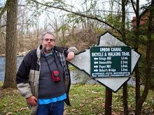
We drove back to the trailhead, I changed back into my trail runners, and Team Raven's Horn posed for a photo. While this isn't the trail entrance we took, it stands in well. Chris, Lee, and I said our goodbyes. I sat in my car wondering "what next?" I had my bike with me, I could have changed into riding gear and put in some miles on the rail trail. Or even just sat on the bank and watched Pine Creek. But even though it was still early afternoon, I felt anything else I did that day would be an anticlimax to the hike. So I drove to Jersey Shore, had dinner, and drove home. And nearly a week later I'm still pondering the question "what next?"
Labels: Caleb's Crew Hiking Club, Hiking, Motivation, Ohio Adventure 2013
 I visited Brandywine Falls, one of the largest waterfalls in Ohio, twice during my trip. The first time was on arrival in the state. I met my friend Matty, down for the weekend from Michigan, and we headed out. Despite a road closure we eventually found our way to the new parking area and walked the short trail to the falls. Most of said trail was wooden steps, and we both found them a bit of a challenge. Matty had more of a struggle due to his weight and the fact the surgery to reconstruct his damaged leg was more recent, but we both got up and down OK.
 The falls were spectacular, despite the summer water flow and a large log stuck at the base of the cascade. The best views were from the lower viewing platform, but the upper platform at the crest of the falls also provides good shots. Its possible to photograph from other locations on the walkway but I found there to be too much vegetation to get an effective image. Hiking is allowed in the gorge near the falls, and when Matty and I visited we saw a photographer parked near the far side of the base of the cascade.
 I returned a week later during a day doing short hikes in the national park, but the photos were not an improvement on the evening shots I'd taken before. So I spent some time walking the new stretch of the Bike and Hike Trail. In 2011 when I rode the trail it switched to a horrible on-road section and I passed the falls without even knowing they were there. Now cyclists can take the Bike and Hike down the hill, over a trail bridge above a highway, and into the parking lot for the falls. Or they can continue past the parking lot, down a corkscrew turn and the trail brings you to the entrance to the upper platform for the falls. The trail continues on a closed road located just above the crest of the falls. When I visited, the trail was closed for resurfacing above the falls, so a rider has to get off the trail at Brandywine Road, as in 2011. Still, this is a big improvement for the Bike and Hike Trail, and probably helps bring more people to the falls.