Thursday, August 22, 2013

Quail Hollow State Park, Hartsville, Ohio, July 2013

The closest I came to an off day during my July trip to Ohio was a rainy Monday. I used the rainy day to advantage, getting a haircut, stocking up on drinks, filling the tank, and exploring parks between showers. I've written about Wingfoot Lake State Park, and my mile of walking looking at the Goodyear blimp moored across the water. That same day I visited another nearby state park, Quail Hollow.

Wingfoot Lake, as I wrote, owes its status as a state park to the generosity of a large corporation. Quail Hollow is a gift of a family. The 700 acres of land, the rock and herb gardens, and the manor were passed down through the Stewart family, chairman of the Akron, Canton, and Youngstown Railroad. In 1975 the Stewarts sold their home and land to the State of Ohio for half its market value, and Quail Hollow joined the state park system.


The park features a nature center in the manor buildings, but unfortunately it was closed when I arrived. My car was alone in the parking lot, and no one seemed to be around. The trails were open, however, and I began to explore. The rock garden was undergoing restoration, but the floral and herb gardens were open. I enjoy the decoration Nature performs, but Man can do a heck of a job too. The gardens were amazing, and a tribute to the volunteers at the local gardening clubs who come in to keep them in shape.

Between the rain and the mosquitoes I kept my walk to under a mile. I enjoyed myself at a park I wish I'd spent more time at. My haircut could have waited; had I arrived earlier in the day the nature center would have been open, and I'd have a better idea of the best hike that afternoon. I have to add Quail Hollow to my "get back to" list.


Labels: , , ,

Encounters With Animals: Possible Cougar Sighting, Mount Davis, PA, August 2010

Stories of a possible sighting of a cougar, also known as a mountain lion, in central Pennsylvania last week prompted me to go public with my account of a possible cougar sighting. I am not a proponent of cryptozoology, and while the cast of Finding Bigfoot might be marvelous fun to hang out with, I don't believe in such creatures wandering around in the woods. Still, this is what I saw, and I believe it was a mountain lion, which according to the PA Game Commission has been extinct in the Commonwealth for a century.

I wrote the paragraphs below a couple of weeks after I returned home after an extended vacation. They are substantially as I wrote them at the time.

"On August 26, 2010, at approximately 10 PM, I was driving to my campsite on Mount Davis after spending the day hiking at Ohiopyle State Park. Mount Davis is the highest peak in Pennsylvania, and the campsite was an unimproved clearing in the Forbes State Forest. The road was unlit aside from my headlights. After I turned onto Vought Rocks Road, I noticed a animal crossing the forest road ahead of me. It was about 20 to 30 feet from the car. I didn't see the creature's head, since it was entering the brush on the left side of the road. But I did get a view of the body. It was tan-colored, with a long tail. I estimate the height of the animal's back as about the height of my car hood. My first thought was "Oh my goodness, that looks like a lion!" It moved like a cat.  I didn't stop to investigate where the beast crossed the road, as it was dark and I didn't know what it was.I didn't have my camera handy so I wasn't able to get a photograph. The sighting was a mile from my campsite. I wasn't too concerned about my safety as I understood such cats to shy away from man.

"I knew it wasn't a deer or bear. It was too large to be a bobcat and the coloring was wrong. It didn't look like a wolf or coyote. I assumed it was a mountain lion, and still believe this. I didn't file a report with PADCNR or the Game Commission because I wasn't aware until yesterday that the mountain lion/cougar is officially considered extinct in Pennsylvania."

I'm open to other explanations of what I saw.

Labels: , ,

Trolley Trail, Erie National Wildlife Refuge, Crawford County, PA, August 2013

Near the end of my vacation I spent two days with my friend Troy on his organic farm near Cambridge Springs, PA. Like most of my friends, Troy is a cyclist and not a hiker, and so we spent our time riding. But I wanted to get my boots dirty at least once more before I traveled to Pine Creek Gorge and took on the Raven's Horn, so I scanned the Internet for a hiking trail. Having stumbled across the Trolley Trail, I planned to hike it one afternoon, after a ride with Troy.

Our trip to Meadville and the Ernst Trail went much longer than I anticipated, and we didn't get back to the farm until very late in the day. I changed from my cycling shoes to my trail runners and drove over to the trailhead outside of Cambridge Springs. The light was beautiful, giving a glow to the surrounding hills. I walked out into the wetlands field surrounding the trailhead with enthusiasm.

But the enthusiasm didn't last. I'm not sure why I turned around a half mile into the 1.5 mile trail. The hiking wasn't difficult. The trail was well-marked and level, and not rocky at all. Looking back, there were probably two reasons I left when I did.

One was it had been a long day. I'd ridden 17 miles with Troy, who is a much stronger cyclist than I am, and even if I didn't feel drained, I had some fatigue. The second was that I'd been two weeks on the road, ridden nearly 240 miles, hiked 8, and driven four hundred some. I'd ridden every day for a week. While I call myself a formerly sedentary man, I'm not to the point I can be active constantly. So I was worn down. Again not so much physically as mentally. I needed, subconsciously, a break. So I turned around.

The problem with turning around where I did was that I missed the best parts of the trail. The Trolley Trail, as the name implies, follows an old trolley line. The trail has small stone bridges further towards Cambridge Springs, and passes near an old cemetery. Had I continued I'd have seen them and stopped for many photographs.

Fortunately for me, the Trolley Trail will still be there. Troy is a friend I don't see enough of and his farm is a slice of heaven. I will be back, and when rested and in a better mood, hike the trail with a lighter heart.


Labels: ,

Western Reserve Greenway, Trumbull County, Ohio, July 2013

As I mentioned at the end of my previous post about the Western Reserve Greenway, having ridden the northern end of the trail, I wanted to ride the southern end. My chance came the day I left Ohio. To get to my next destination, Erie, I had to pass near the trail, so I plotted a course to the Oakfield Trailhead, between Ohio Routes 87 and 88.

The stretch of the Trumbull County section of the trail I rode, between the two numbered Ohio roads, was very much like the Ashtabula County section - passing through woods and farmland. The highlight of the ride was stopping at the Mosquito Lake Wildlife Management Area, just a couple miles north of the trailhead. A wooden observation platform stands next to the trail, and gives you a great view of the small lake. The platform is old and rickety, and the area is a favorite for ducks and geese, to judge from the droppings on the trail. I had to dismount and walk carefully when I stopped for photos.

Like the northern end, the trail has a lot of road crossings, but most of them were on little used roads. Still, there were signs posted stating traffic doesn't stop for trail users. I don't know if it was a Buckeye State way of emphasizing that one should be careful at crossings, but I used caution riding across the roads.  I walked my bike across Ohio Route 88. By then I realized if I continued riding south I'd be running short on time to ride in Erie, and so I crossed back and returned to the car.

The ten miles I rode were a wonderful break from the long drive to Erie. When I'm back in Ohio I'll be sure to ride the Western Reserve Greenway again. Peter, my host, suggested riding the whole 43 miles out and back, and that's a possibility once I get my fitness back. But really, any section would do.


Labels: ,

Wednesday, August 21, 2013

Brecksville Reservation, Cuyahoga Valley National Park, Ohio, July 2013

I had one sunny day set aside for hiking during my Ohio vacation last month, and I started with a mistake. No, the mistake wasn't beginning with Brecksville Reservation in the Cuyahoga Valley National Park. It was assuming Brecksville was a beginning, and I was going to be going to a lot of places in different locations in the park. Instead I turned into an outdoorsman version of the tourist in Art Buchwald's "three minute Louvre" column, and in trying to see everything saw next to nothing.

Brecksville is on the west side of the Cuyahoga River, on Route 82. The day I visited the sun was out, the temperature was up, and the park was crowded with families. I started with a short walk to the Environmental Education center, feeling cooler under the trees. The center itself is in an old Civilian Conservation Corp cabin, and has displays geared towards introducing children to the outdoors. After a few minutes there learning just what might be hiding under an old log, I resumed my walk.


The highlight of this part of the park was the miniature prairie. I've seen pint-sized wetlands in Pennsylvania parks, but I was impressed with Brecksville's presentation. I spent a few minutes walking through the fields, observing the bees and butterflies and the flowers. I felt light at heart. At least until I realized I had a schedule. I should have stuffed the schedule in my pocket - carry in, carry out - and spent the day here. Instead, I moved on. Further down the park road by car, when I could have hiked it.


 My second stop in the park was along Chippewa Creek. The waterfall on the creek is a popular lunch stop for local residents, as the overlook to the gorge has a half-dozen picnic tables, and all were occupied when I was there. The falls themselves are visible from a distance, hidden under a bridge. There were signs posted warning not to enter the gorge, and I'd not have attempted to scramble down the rock walls.


From the picnic and parking area at the falls runs a wooded trail that leads back to the Environmental Education center. I hiked a mile of it. As usual with hiking in Ohio, the trail surface was a pleasure compared to Rocksylvania. The portion of the trail I hiked ran along the edge of the gorge, and at one pointed turned onto an overlook upstream towards the falls. No picnic tables here, just woods and me. The shade was comforting in the still Ohio heat. I hiked about a mile total along the Chippewa. Time, and the fact I'd decided to try new insoles in my boots and they weren't working out, cut short my hike. I went back to the car, change to my trail runners, and drove on to my next stop.

I had a good day, and enjoyed everything I saw, but in the end I would have been better served by staying put. My mental rush was partly caused by the length of time it took me to get to the park from my host's home outside Akron. Had I left early in the morning I'd have beaten the heat as well as northbound traffic and have been able to hike longer. Or I could have left the Tinker's Creek and other sites for another day.

Also, my old sedentary habits might have been manifesting themselves again. When I am alone my hikes and rides tend to be shorter and easier. All my hiking in Ohio was alone, since most of my friends are cyclists and not hikers. So I rode up to 36 miles at a time in Ohio but had no hike over a mile.

So the long and short of it is that I tasted Brecksville Reservation instead of drinking it deep. Next time I am back in Ohio I need to hike that entire trail along the Chippewa and spend a day enjoying the park, instead of driving all over.

Labels: , ,

Monday, August 19, 2013

Western Reserve Greenway, Ashtabula, Ohio, July 2013

During the planning for my 2011 attempt to ride across Pennsylvania and part of Ohio I came across a rail trail named the Western Reserve Greenway. This 43 mile trail ran from near Lake Erie in a town with the melodious name of Ashtabula to just south of the road I'd be riding to my night stop on the first day of the tour. The trail didn't fit into my plans for that trip but I mentally noted it for a future ride.

Two years later I was back in Ohio. My host, Peter, wanted to ride the Western Reserve Greenway. I did as well. We differed on how we wanted to ride it, however. My idea was to ride the length, and then camp overnight at nearby Mosquito Lake State Park, riding back the next day. Peter wanted a day ride. After thinking about it I reached the conclusion that an overnight tour would be too much, not in terms of the number of miles, but in the time and effort to do it. So we set up a day ride for a Sunday and hoped for good weather.

We had the weather we wanted, sunny, mild but not hot, and a slight breeze. We parked near the northern end of the trail and followed it to its conclusion, a dead end at railroad tracks a mile from the lake. Turning around, we headed south on the paved path, Peter's trike racing my touring bike. We had a slight problem at the trail closure at Interstate 90, but we dismounted and walked through the construction. By the time I post this ride report the construction might be complete and the trail reopened.

The trail has many road crossings, but it rambles through Ohio farm country, so the scenery is great. From Astabula the trail moves up a slight grade, but levels off once past Interstate 90 and continues flat aside from some road crossings and a quarter-mile on road detour at the town of Rock Creek.

Just south of the road segment is Rock Creek Trestle. This structure has an observation deck on the side with three picnic tables, and it was here we stopped for lunch. After 15 miles and the long drive from Akron I was hungry, and while my Brooks saddle is breaking in, it felt good to be seated. Peter as a trike ride brought his lounge chair with him, of course.

Once we were fueled and rested, we continued south. I needed to, ahem, unhydrate, and there was no bathroom at the trestle. We continued south past a swamp and more farm country until Peter and I found what we needed. Mission accomplished at the 18 mile mark, we turned around and headed north.

By now the sun had been covered with clouds, and the temperature was dropping. I felt like rain was on the way. As Peter and I argued over the forecast I scanned the skies. I subconsciously pushed the pace, and Peter asked me to slow down a few times.

By the time we'd made it through the construction zone at Interstate 90 the first raindrops fell. I stopped to take a couple of photos and told Peter he didn't need to wait for me. Perhaps excited at riding a downhill, h took off. I struggled to keep up. The feared rain turned out to be a minute of a shower, and that's it. Still, I pushed hard on the final miles.

I was tired but pleased with my efforts as I helped Peter put my bike on his rack. We'd ridden 36 miles, which was my longest ride since July 2011. My fatigue found me the next day, and I restricted myself to a short recovery ride. But while the Western Reserve Greenway ride was exhausting, it was worth doing.


Labels: ,

Sunday, August 18, 2013

Prang! - Delaware and Raritan Feeder Canal Towpath, August 2013

For once I wasn't the one having problems on a ride. But its best to start this story at the beginning.

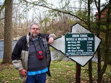
Needing to get in miles for the upcoming MS City to Shore, I decided to take on a half-century on the Delaware and Raritan Canal Towpath. The Scudder Falls trailhead, a few miles north of Trenton along the feeder canal and Delaware River, is 25 miles from Frenchtown. My friends Chris and Anthony said they would join me as they too needed to get in miles for the MS ride.

We left the trailhead and headed north at 10 AM. However, we didn't get far before Anthony called attention to Chris' rear tire. It was cracked and bulging. Chris seemed unconcerned, but Anthony is a very experienced rider, and on his recommendation we pulled into the only bike shop on the trail, ten miles up in Lambertville, for a new tire.

Once Chris' bike was serviced and road-ready,  we continued north. I'd last ridden the towpath in 2007, and I'd forgotten how good the pea gravel surface was. Yes, there were stones in places, and some tight gates to ride through, but aside from my continuing problem with numbing hands I made good progress. And the scenery was gorgeous. Floodgates and spillways flowed, and the Delaware River often came into view. Even though we'd lost a lot of time at the bike shop, the three of us felt confident and strong.

And then Chris had his seat give way.

My friend Chris weighs 420 pounds, and his bike is a Day Six pedal-forward model. The bulk of his bulk is on a wide seat with a back. Early on, Chris broke his seat and he fixed it himself with plywood. While that resolved the problem of his bike ever being stolen, it added to the weight on the seatpost. And it turns out the adjustable seat is secured by a single bolt.

One guess what failed. Four miles from the bike shop, just past the town of Stockton.

The three of us came up with a plan. Chris was going to start walking back to the bike shop. Meanwhile Anthony and I rode back to the shop, hoping they'd have a bolt that would fit. After the staff got over their surprise to see us again, they did find a bolt that would work. And we headed back, meeting Chris halfway between Lambertville and Stockton.

I'm not mechanically inclined, so Anthony and Chris started working on repairing the seat. They had just gotten the bolt installed when they discovered the threads on the clamp that holds the bolt had been stripped.

Chris' ride was over. But not for Anthony and me. Chris drives a stick, and neither Anthony nor I could drive his car. This meant I had to get back to retrieve my big friend and his bike. Since Chris had spent all his cash on a tire three hours before, I gave him ten bucks in case he could find a New Jersey Transit bus in Lambertville that could take him back to near the trailhead. Anthony joined me, but I suggested he darken the door of the bike shop yet again in case they had a clamp, or could fashion a healer coil for the stripped clamp.  The two remaining riders headed out as Chris resumed dragging his bike to Lambertville.

I reached the car after a few stops to let blood back into my hands, and after a sweaty and exhausted Anthony caught up to me at Washington's Crossing State Park. Anthony babysat my bike while I drove the fifteen miles back to Lambertville. A tired and forlorn Chris was sitting on the steps of the closed bike shop with his wounded bike.

Of the planned 50 mile ride, I finished with 34. Anthony's total was a bit more, probably 38 by my calculating. Chris completed 15 miles of riding and four of walking the bike. Not a good day for him with five weeks until he attempts a century. On Tuesday he's going to get the bike repaired so he can get in the miles he needs to be ready for September 28. And as his Team Captain, I'll do my best to get him across that finish line.


Labels: , ,

A Taste For The Woods: 2013-08-18

This page has moved to a new address.

A Taste For The Woods