Sunday, May 11, 2014

Caledonia Falls, Caledonia State Park, May 2014

A waterfall is loosely defined as water traveling over a precipice, but man is a defining creature and no one is going to leave it at that. Scott Brown and Gary Letcher in their books on waterfalls and Raymond at PAWaterfalls.com all ignore Caledonia Falls for one reason or another. Yet it might be one of the most photographed waterfalls in Pennsylvania, simply because of its location on PA Route 233 and US Route 30 in Caledonia State Park. Whenever I am in the area, or passing west on 30, I stop for a few minutes, take the walk up the entrance to the Thaddeus Stevens Trail, and visit the waterfall.

Caledonia is a true cascade, as water spills from rock to rock as the old mill race flows downhill to Mountain Creek, meeting under the road. Its easy to photograph from the top, as I've done here, or from either side. Unfortunately shooting from the road requires standing on the shoulder on either side, which can be a little unnerving as cars and trucks go past. Still, I think its worth the effort, and unlike most waterfalls you need to invest little effort in hiking, as the falls are a few feet from the parking area. During the summer the flow is little more than a trickle, but after the spring runoff or a heavy rain the falls are impressive.


Labels: ,

Adams Falls, Ricketts Glen State Park, April 2014


The most visited cascade at Ricketts Glen is arguably Adams Falls, the final named falls on Kitchen Creek. Its the easiest to access, being only a short walk from the parking lot on Route 118. Adams Falls was where I met Raymond of PAWaterfalls.com before starting our hike in State Game Lands 13, and he spent a few minutes with me photographing the cascade. At 7:30 AM we had the falls to ourselves, and since solitude is a rarity at Ricketts Glen, we made the most of it.  This is once again an instance where my photos do not do justice to the subject. Now, if someone would only remove the logs in the upper cascade and lower plunge pool.....

Labels: ,

Wednesday, May 7, 2014

Sullivan Run, State Game Lands 13, April 2014

This blog is a diary. But I don't write it for myself. This is a story of how you, my readers, pushed me to do what my heart told me I should try.

State Game Lands 13 lies a dozen miles west of Ricketts Glen State Park. A State Game Lands tract in Pennsylvania is owned by the Commonwealth and open for hunting and fishing in season. With a few exceptions there are no blazed or maintained trails, no parking aside from roadside pulloffs, no visitor center, no park rangers and no maintained roads.


Which is why despite SGL 13 having nearly as many waterfalls as Ricketts Glen, there are no crowds. The only people who hike to the waterfalls are local residents and people who might have read about the falls on the Internet, or in Jeff Mitchell's book Hiking The Endless Mountains. 

Its Mitchell who coined the phrase "Waterfall wonderland" to describe the seventeen cascades on Heberly, Sullivan, Pigeon, and Orr Runs. Mitchell's book also details the eight mile hike to see all these falls. However, don't expect a walk in the park. There are no trails, only an old forest road or two and a lot of bushwacking. And to see all the falls you have to be prepared to scramble up and down hills and hike IN the stream and climb up the cliffs alongside the falls. Mitchell advises allow eight hours for the eight mile loop, never hike it in icy conditions, and never hike it alone.

So naturally, having read all this, I wanted to do the hike. Or at least part of it. Fortunately Raymond, the manager of the Pennsylvania Waterfalls Facebook group and the owner of the Pennsylvania Waterfalls website, offered to meet and guide me on the Sullivan Run leg of the hike. We set aside the last Sunday in April, and I arrived at the meeting place with hiking poles and hip waders. Ray drove us to a gravel lot in the SGL and we headed towards our first waterfall, Sullivan Falls. It was an impressive sight, and I was glad I didn't have to hike up it.

From Sullivan we followed an old forest trail, crossing a stream and then the top of Pigeon Falls. The water flow was high with runoff, but we had no trouble crossing. Even from the top Pigeon Run, and the falls, were beautiful. I could hardly imagine what they looked like from the glen below.

My problem began with the bushwack down the hill. As readers know I have from time to time trouble with descending steep slopes, and this was one time. I went down a few feet and stood there. Ray had hiked halfway down and he stared at me. Finally he said "We can turn back if you want. Its' OK."

I was afraid. I was nervous. But I didn't want to turn back. I wanted to see the falls. And there was another reason. "Ray, I write a blog about going out and doing things. If I don't at least try, I'm a liar and a fraud." A man takes risks, I told myself. And a big risk was in front of me. I told myself when I lost 160 pounds I wasn't going to live a boring life. Well, time to follow through.

But how to get down the hill? I looked at the ground, the usual Pennsylvania scree and grass, and remembered my Ravenshorn hike. "Ray, don't laugh, but I'm going to do a controlled slide down the hill." I sat down and scooted, using my legs to maneuver away from big rocks and trees. By the time I reached a point I could stand and walk down I'd blazed what I called a "big ass trail" and decided Cabella's is now my official hiking outfitter - those pants can survive anything.

Once in the glen, it was a matter of walking alongside Sullivan Run, walking IN Sullivan Run, and climbing on the cliffs. I was very slow and Ray was very fast, but we managed OK. I think he expected I was a better, stronger hiker when he offered to meet me, but we both learned fast - he that I'm slow but determined, me that I can do more than I imagine. And that includes climbing a waterfall. Or in this case, two.


Our hike continued to one of the few named cascades on Sullivan, Atticus Falls. Ray scampered up the side of the falls, and gave me advice from above on how to get up. This time I didn't succeed. It wasn't the will or the knees failing, it was the lack of flexibility in my hips that did me in. I couldn't bring my leg up that high to reach the shelf I needed to. As a result I stood half in, half out of the water flow. Finally I said "I can't", and carefully climbed back down the falls face. I wasn't upset, as I had given my all. My all wasn't enough, at least this time. 
Ray bushwacked up the side of the hill, followed by me very slowly. Going up doesn't activate my fear of heights, but the ground was soft and uneven, and I didn't want to fall. Once at the top we stopped, had lunch, and I amused Ray by pouring what seemed gallons of water from my waders. Once we ate and I struggled to get my boots back on we hiked back to the car. 

Will I ever do the complete loop in the Waterfall Wonderland? I don't know. I'd like to.  I was tested this hike. I'm not sure I passed or not. But the important thing is that I took the test. Thanks to Ray for guiding me, and for you, the readers of A Taste For The Woods, for helping to keep me a formerly sedentary man rediscovering the outdoors. 

Labels: ,

Tuesday, May 6, 2014

Falls Trail, Ricketts Glen State Park, April 2014

This hike was a failure or a success, depending on what you are looking for. I'm still not sure which it is.

The last weekend in April I spent in Pennsylvania's waterfall country - the northeastern part of the state. Due to quirks of geology this region has waterfalls cascading all over. And the crown jewel is Ricketts Glen State Park.

The park is named for Colonel Ricketts, hero of Gettysburg and lumber baron. Wikipedia has an astonishingly detailed account of the history and geology of the park, and I have nothing to add. I'll just state that hiking alongside 22 waterfalls isn't something to be missed. And I tried not to miss it.

My trip north was delayed, as once again I had to work late the night before. I arrived at the park about five PM and set out to hike the abbreviated version of the Falls Trail. The complete Falls Trail is a balloon or lollipop hike, starting at Adams Falls on Route 118 and heading north to Waters Meet, at which point you hike up either Kitchen or Fishing Creek. When you reach the Highland Trail you head to the other creek and hike back down to Waters Meet and return to your car. This is a hike of over seven miles, but you can cut four miles off by starting on the Highland Trail and hiking along both creeks, but skipping the trip down to Rt 118. You miss a couple of waterfalls, but you see the bulk of them.

In fact what happened is I missed the bulk of them. That afternoon I tried to hike down the Ganoga Glen side of the trail and I had my fear of heights kick in at the top of the steps down 33 foot Mohawk Falls. Knowing that navigating century old slate steps would be what I'd face the entire hike, I turned around.

The following afternoon I tried again. I was in a good mood, having not only hiked alongside waterfalls that morning at State Game Lands 13, but up their faces as well. This time I started from Adams Falls and headed north. determined to get as far as I could. The trail along Kitchen Creek is level as far as the first waterfall, sixteen foot Murray Reynolds, but the trail gets rougher as you approach the second, 36 foot Sheldon Reynolds. Once again the steps deterred me, this time due not only to a fear of heights but joint swelling. Climbing up waterfalls is hard work, and I'd worked hard that morning. My body was telling me I'd had enough.

So, was the Falls Trail a bust for me? Some might call it a failure, but I can't. I saw four marvelous waterfalls - Adams, Mohawk, and the two Reynolds - and had a great hike along Kitchen Creek. As for those stairs, I feel confident I can do the entire seven mile loop if I start fresh and rested, and take the usual care I do when hiking. Ricketts Glen is a marvelous place to hike, and I will be back to do the Falls Trail.

Labels: ,

Tuesday, November 26, 2013

Bushnell Falls, Shandaken, NY, October 2013


This is a "hike" of 100 yards or so, but I thought I'd mention it. Bushnell Falls is on Route 42 North from the town of Shandaken. Five miles northbound there is a pulloff to the left. (Scott Brown's book on New York waterfalls has an error and puts the parking area on the other side of the road.) A walk on a short trail brings you to the falls. The day I visited it was a trickle down the side of Halcott Mountain, but after a rain or in spring it will be a more impressive cascade.

As the weather was dry and the flow minimal, I ventured onto the falls itself. Of course my fear of heights kicked in as I tried to leave and it took me ten minutes to get off of a ledge that it took ten seconds to get onto. Sometimes its really, really tough to be me. But discovering Bushnell Falls, a piece of beauty I'd have driven past when I sedentary, makes up for the occasional problems.

Labels: , ,

Wednesday, August 21, 2013

Brecksville Reservation, Cuyahoga Valley National Park, Ohio, July 2013

I had one sunny day set aside for hiking during my Ohio vacation last month, and I started with a mistake. No, the mistake wasn't beginning with Brecksville Reservation in the Cuyahoga Valley National Park. It was assuming Brecksville was a beginning, and I was going to be going to a lot of places in different locations in the park. Instead I turned into an outdoorsman version of the tourist in Art Buchwald's "three minute Louvre" column, and in trying to see everything saw next to nothing.

Brecksville is on the west side of the Cuyahoga River, on Route 82. The day I visited the sun was out, the temperature was up, and the park was crowded with families. I started with a short walk to the Environmental Education center, feeling cooler under the trees. The center itself is in an old Civilian Conservation Corp cabin, and has displays geared towards introducing children to the outdoors. After a few minutes there learning just what might be hiding under an old log, I resumed my walk.


The highlight of this part of the park was the miniature prairie. I've seen pint-sized wetlands in Pennsylvania parks, but I was impressed with Brecksville's presentation. I spent a few minutes walking through the fields, observing the bees and butterflies and the flowers. I felt light at heart. At least until I realized I had a schedule. I should have stuffed the schedule in my pocket - carry in, carry out - and spent the day here. Instead, I moved on. Further down the park road by car, when I could have hiked it.


 My second stop in the park was along Chippewa Creek. The waterfall on the creek is a popular lunch stop for local residents, as the overlook to the gorge has a half-dozen picnic tables, and all were occupied when I was there. The falls themselves are visible from a distance, hidden under a bridge. There were signs posted warning not to enter the gorge, and I'd not have attempted to scramble down the rock walls.


From the picnic and parking area at the falls runs a wooded trail that leads back to the Environmental Education center. I hiked a mile of it. As usual with hiking in Ohio, the trail surface was a pleasure compared to Rocksylvania. The portion of the trail I hiked ran along the edge of the gorge, and at one pointed turned onto an overlook upstream towards the falls. No picnic tables here, just woods and me. The shade was comforting in the still Ohio heat. I hiked about a mile total along the Chippewa. Time, and the fact I'd decided to try new insoles in my boots and they weren't working out, cut short my hike. I went back to the car, change to my trail runners, and drove on to my next stop.

I had a good day, and enjoyed everything I saw, but in the end I would have been better served by staying put. My mental rush was partly caused by the length of time it took me to get to the park from my host's home outside Akron. Had I left early in the morning I'd have beaten the heat as well as northbound traffic and have been able to hike longer. Or I could have left the Tinker's Creek and other sites for another day.

Also, my old sedentary habits might have been manifesting themselves again. When I am alone my hikes and rides tend to be shorter and easier. All my hiking in Ohio was alone, since most of my friends are cyclists and not hikers. So I rode up to 36 miles at a time in Ohio but had no hike over a mile.

So the long and short of it is that I tasted Brecksville Reservation instead of drinking it deep. Next time I am back in Ohio I need to hike that entire trail along the Chippewa and spend a day enjoying the park, instead of driving all over.

Labels: , ,

Friday, August 16, 2013

Viaduct Park, Cuyahoga Valley National Park, Ohio

Following my visits to Tinker's Creek Gorge Overlook and Bridal Veil Falls, I continued up Overlook Drive and turned north to Viaduct Park. This little gem is on the northeastern edge of Cuyahoga Valley National Park, and sits in the suburbs of Cleveland. And it sits so quietly there that I missed the entrance when I was looking for it and had to turn around. The parking area looks like a company lot for the factory next door, so its an easy mistake to make.

Once I arrived I walked past the viaduct that gives the park its name. Once a railroad bridge, its now an overlook that gives you a spectacular view of the Tinker's Creek gorge. I decided I'd go onto the old viaduct after I walked the trail into the gorge, so I continued straight down the sloped, paved pathway. There were numerous interpretive markers to read. The gorge was once an industrial area, and I passed the ruins of a mill and a generating station as I walked into the shaded gorge.

Once I reached the end of the paved path I stepped onto the pea-gravel walkway along Tinker's Creek. There were the falls. I'd been hearing the crash of the Great Falls on Tinker's Creek as I walked down, and here they were. The spray was cooling on the hot day. I found multiple places to photograph from on the walkway, but the main observation platform provided the best angles. Unlike Brandywine Falls, its hard to see how a photographer can hike into the gorge aside from the trail. So unless you shoot from the viaduct for an 'up the gorge' shot all your photos of the falls will be from the right side. I've included two photos from different locations to show what I had to work with.

The whole hike was about a half mile round trip. Like most attractions in Cuyahoga Valley National Park, Viaduct Park is easily accessible. And it was worth the small effort to see the falls.

Labels: , ,

Sunday, August 11, 2013

Bridal Veil Falls, Cuyahoga Valley National Park, Ohio

A couple of miles up Overlook Drive is the trailhead to Bridal Veil Falls, one of the many attractions of Cuyahoga Valley National Park. Like the bigger and better known Brandywine Falls and the Great Falls on Tinker's Creek, the hike to get to the falls is relatively short. The descent from the road is on a wide gravel path, wooden walkways, stairs, and a bridge. Once you cross Deer Lick Creek turn right on the trail and in a few steps you are in at the observation platform. From there you have a great view down into the gorge, and of the long path the water has carved over the slate. If you continue your hike Buttermilk Falls is further up the trail. I decided to stop at Bridal Veil today, having other places to visit in the park.
On this trip I found the shooting conditions from the platform to be difficult. I was getting lots of highlighting in the images, and nothing seemed to tame it. So I walked back to Deer Lick Creek and  took photos from the crest. Free from the deep green of the gorge my photos came out better, and I felt at peace as I watched water on stone. The creek was a summer trickle, and with some care I walked through the water on the rocks. I spent an hour on a hike of less than a half-mile total, and I could have spent another hour. It was time worth investing. 


Labels: , ,

Friday, August 9, 2013

Brandywine Falls, Cuyahoga Valley National Park, Ohio

I'm tagging this as a hike, although I'm not sure its a long enough walk to qualify as one. However, since sets of steps are involved, its work.

I visited Brandywine Falls, one of the largest waterfalls in Ohio, twice during my trip. The first time was on arrival in the state. I met my friend Matty, down for the weekend from Michigan, and we headed out. Despite a road closure we eventually found our way to the new parking area and walked the short trail to the falls. Most of said trail was wooden steps, and we both found them a bit of a challenge. Matty had more of a struggle due to his weight and the fact the surgery to reconstruct his damaged leg was more recent, but we both got up and down OK.


The falls were spectacular, despite the summer water flow and a large log stuck at the base of the cascade. The best views were from the lower viewing platform, but the upper platform at the crest of the falls also provides good shots. Its possible to photograph from other locations on the walkway but I found there to be too much vegetation to get an effective image. Hiking is allowed in the gorge near the falls, and when Matty and I visited we saw a photographer parked near the far side of the base of the cascade.

I returned a week later during a day doing short hikes in the national park, but the photos were not an improvement on the evening shots I'd taken before. So I spent some time walking the new stretch of the Bike and Hike Trail. In 2011 when I rode the trail it switched to a horrible on-road section and I passed the falls without even knowing they were there. Now cyclists can take the Bike and Hike down the hill, over a trail bridge above a highway, and into the parking lot for the falls. Or they can continue past the parking lot, down a corkscrew turn and the trail brings you to the entrance to the upper platform for the falls. The trail continues on a closed road located just above the crest of the falls. When I visited, the trail was closed for resurfacing above the falls, so a rider has to get off the trail at Brandywine Road, as in 2011. Still, this is a big improvement for the Bike and Hike Trail, and probably helps bring more people to the falls.


Labels: , , , ,

Wednesday, July 3, 2013

Kennerdale Overlook and Freedom Falls, Venango County, August 2010

Its amazing how much outdoor fun you can have on an "off day" on vacation. On my August 2010 trip into western Pennsylvania I spent one morning getting groceries and doing laundry in Oil City, along with my friend Judy. But once we had food and clean clothes for the next few days, we had the afternoon free.

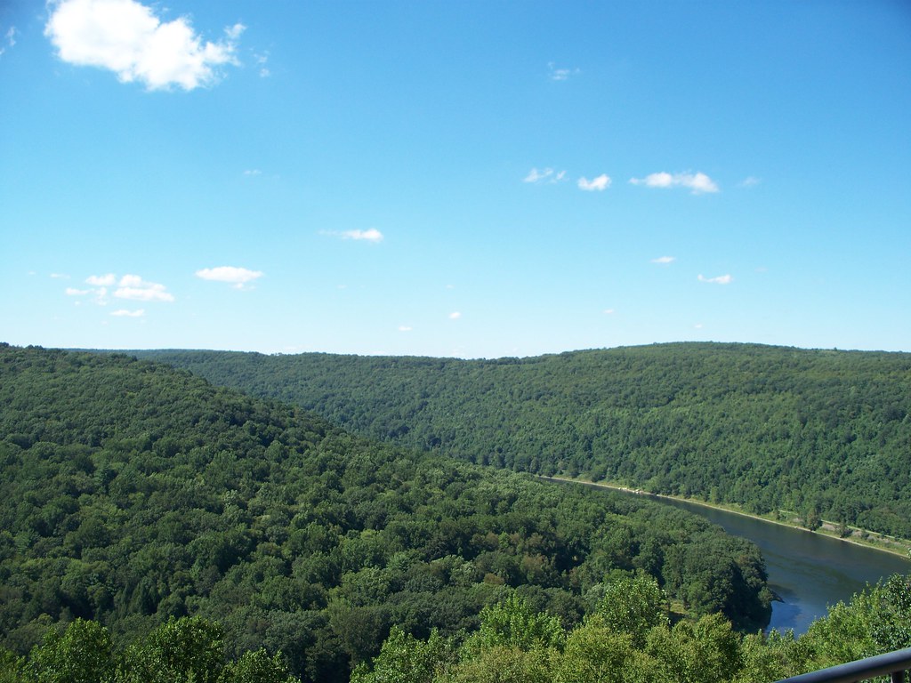
I brought with me on this trip several guidebooks about scenic places in the state, and while my clothes were in the washer and dryer I searched for spots in the Oil City area. We discussed riding the Sandy Creek Trail again, and so I got into my riding gear.  Before we went to the trail, however, we made a trip to Kennerdell Overlook. The sky was clear, and so we had a spectacular view of the Allegheny River. I saw there seemed to be a hiking trail near the overlook, but we left that for another day.


One of my guidebooks mentioned a waterfall, Freedom Falls, with a short and easy hike from the road. Assuming we would be able to easily find the small road it was on, we postponed the planned ride till later that afternoon. Finding the falls turned out to be a challenge involving a lot of driving around on back roads. Once we found the parking area we experienced a harder than advertised hike to the falls. The distance was short, but the hillside steeper than we expected. Judy was OK but I had a little trouble, for I was dressed for riding as I hiked, wearing full kit and Crocs.

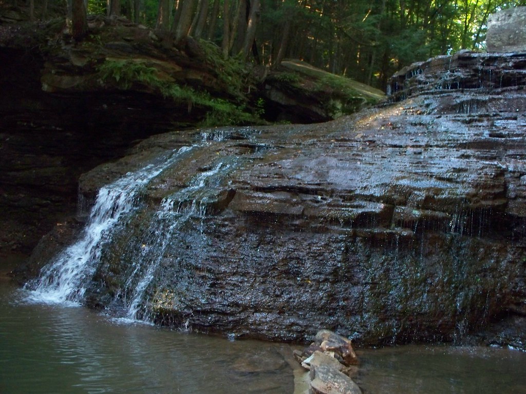
Once we reached the falls, we found it was worth the trip. Freedom Falls is big, standing over twenty feet tall and fifty feet wide. Even in the middle of an August dry spell it was impressive. The water flow in Shull Run was low enough that I could stand safely near the lip of the falls and shoot down into the plunge pool. Talk about not having a net!
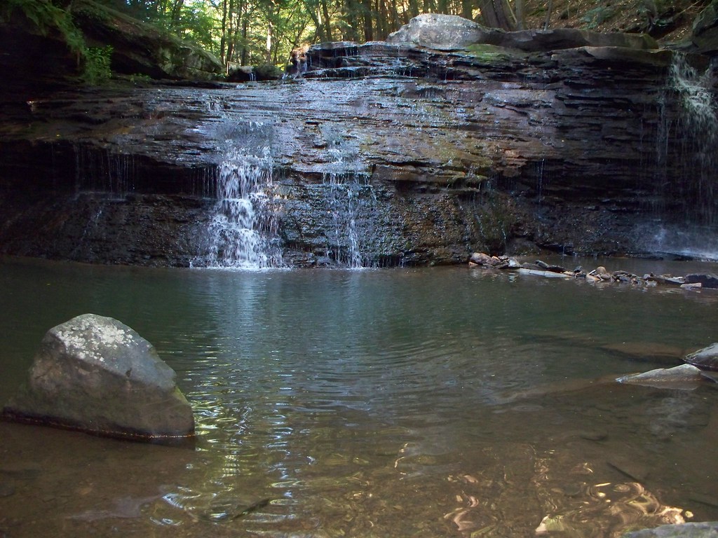


Once I'd taken photos from the top, it was time to see the face of the falls. I returned to the bank of the run and made my way down to the plunge pool. I hesitated at first, but then went in.  The water level was below my knees, and refreshingly cool. Crocs were the perfect wading shoe, and I'd have not gone into the water had I been wearing hiking boots.


Photography is a fascinating subject, but I'm not a skilled photographer, nor do I have anything beyond a point and shoot.  But I do try to practice the good advice I've been given or read. One of my favorite guidebook writers is Scott Brown, author of Pennsylvania Waterfalls. Brown advised when shooting to use a lower shutter speed and a tripod, and to try to use a filter to reduce background highlighting. The woods were showing up as very bright, and since the falls as a whole weren't heavily flowing I focused on segments of the waterfall. This let me make the water the focus and allowed me to 'crop' out the woods. I won't call my photos professional or serious, but they pleased me very much. And they still do. Seeing them again reminds me of a cool afternoon along and in Shull Run.


Not quite as cool was the climb uphill. I suppose I could get a decent footing in Crocs, but my pair are a size larger than my hiking boots, and my wet feet shifted in them as I climbed. I must have looked ridiculous to anyone who saw me; a fat, knock-needed guy in bib shorts, jersey, and orange Crocs climbing up a hill on hands and knees.


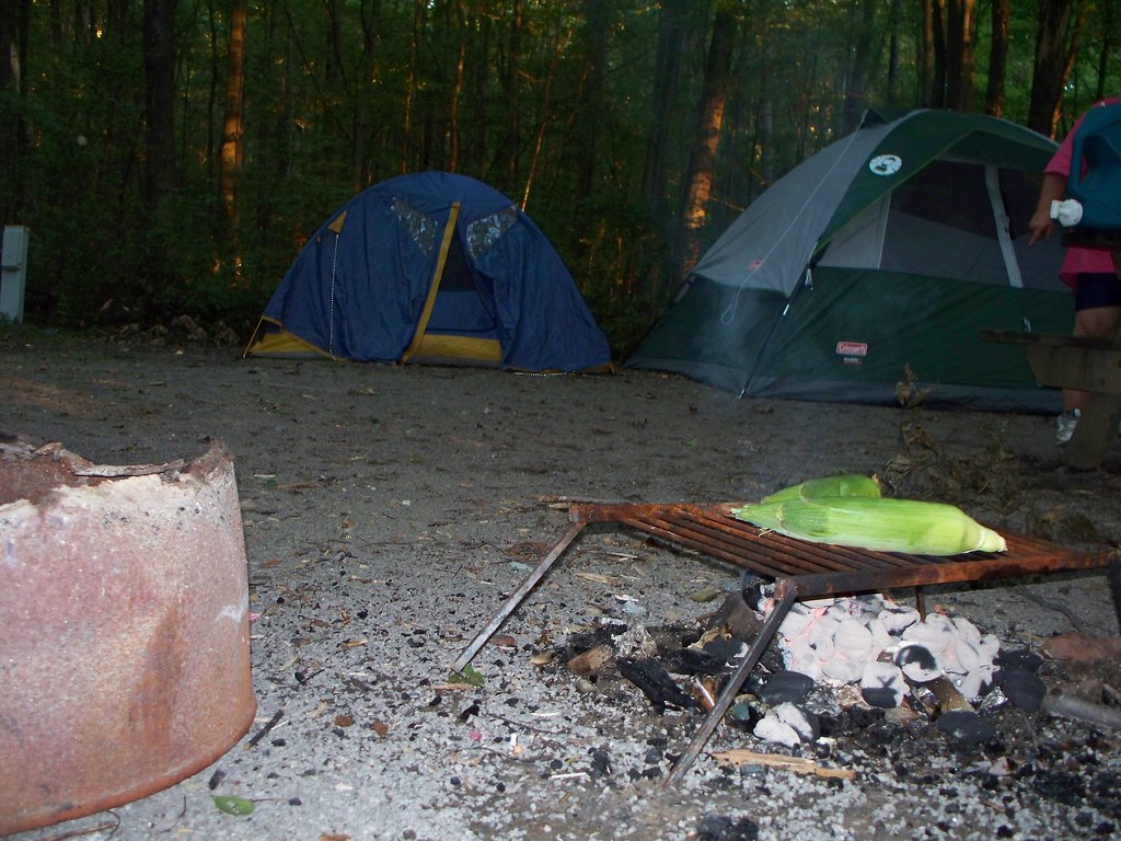
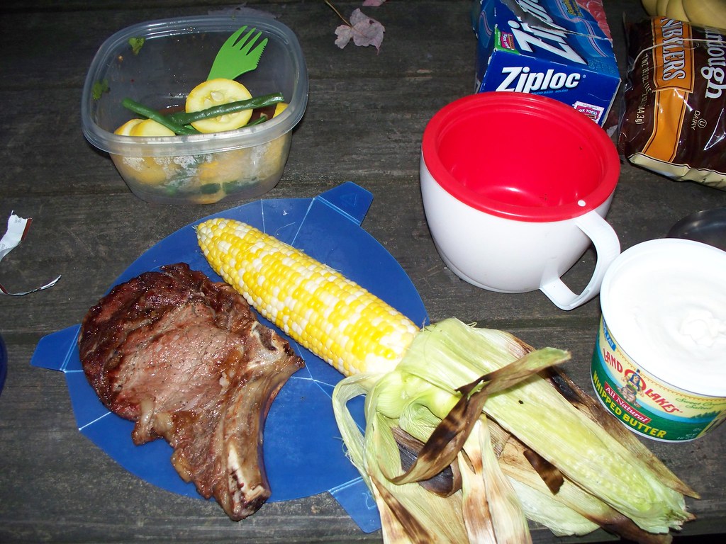
We spent an hour and a half hiking and shooting at the falls, and for an off day I'd worked up quite a hunger. Having gotten in an adventure, we decided Sandy Creek could wait for another day, so we headed back to our campsite at Two Mile Run County Park. I'd offered to make dinner, but on discovering that my campfire specialty was tuna hash, my companion decided she would cook. That evening Judy showed off her skills at camp cookery with steak, corn on the cob, fresh beans and squash, and tea, prepared over the fire pit an on her stoves. It capped an exciting and active "off day" for the two of us.


Labels: , , , ,

Saturday, June 29, 2013

Ohiopyle Falls, August 2008

In my last post I wrote about a young man who climbed onto a dew-slick railing to photograph the fog inversion at Bradley Wales Vista in Pine Creek Gorge. That same post mentioned I climbed over the fence at Barbour Rock to shoot down into the canyon. However, the photo below puts both of them in the shade. Its one thing to climb over a fence when alone in the middle of nowhere. It's another to do it in a busy state park only a thousand feet from the visitor center. The photo below is Ohiopyle Falls from the observation area in August 2008. The young man gives some perspective to the photo, but still, he shouldn't have been there.

Labels: ,

Monday, June 24, 2013

The Wild Side: Fern Cliff Peninsula, Ohiopyle State Park, August 2010

This is one of the most photographed waterfalls in Pennsylvania. 

But its shot from the 'wrong' side. You can see the observation platforms in the photo. Obviously I should have been on the other side of the cataracts with the thousands of other visitors.  That's the side of the river with the boat launches, and the visitor center, and the pizza place, and market..... In other words, the Ohiopyle State Park everyone visits. But just across the bridge, accessed from a parking lot or the Great Allegheny Passage trail, is a wild side to Ohiopyle. The Fern Cliff Peninsula is the Ohiopyle no one visits, and in many ways its the best part of the park. A stick of land jutting out into and partly surrounded by the Youghiogheny River, the peninsula has one of the best short hikes in the state. When I hiked it on a late afternoon in August 2010, I saw only one other person during the slightly more than two miles that passed under my boots. 

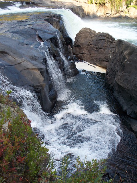
The trail I hiked was less rocky than most of the trails in Penn's Woodlands. The rockiest portion was near the falls. To get the photos above and below I had to walk out onto the rocks at the edge of the cascade. The river flow was lower than normal due to the drought conditions; I'd hate to imagine what the river and falls would look like in spring after the snow melt. 


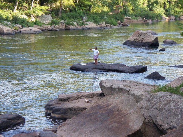
Just downriver of the falls, I saw the only other man on the peninsula. Well, he wasn't quite ON the peninsula. But I'm guessing he had to swim  or wade over to his fishing perch from the peninsula side, if only because the distance was shorter. Not that I'd swim within 200 feet of the falls, or swim with a fishing pole. Or for that matter swim in my underwear. Then again, its Westsylvania. Things are different here. 

As you get further away from the falls, the trail takes you through a forest of pine and hardwood. But you are never very far from the water. The sound of the river crashes around you as you walk, following it as it drops 90 feet rounding the peninsula. It drowns out the tread of your boots on pine needles and dead leaves.  As I walked through the woods, I thanked the men and women who saved the peninsula, and the whole of Ohiopyle State Park, from becoming a vacation resort decades ago. As I finished my hike, I kicked myself for having visited Ohiopyle three times before and never once taking a walk on the wild side. I know it won't me my last time at Fern Cliff Peninsula. 


Labels: , , , ,

Sunday, June 2, 2013

Tumbling Run Trail, Tumbling Run Game Preserve, Michaux State Forest

Memorial Day was partly spent on the worst kept secret in Penn's Woods. The Tumbling Run Game Preserve is tucked into Michaux State Forest and plastered with No Trespassing signs, but when I arrived the trailhead was overflowing with cars and vehicles were parked up and down the shoulder of Route 233. The owners of the preserve are busy turning their heads as hikers visit their trails.

I write "trails" as there is more than one. Although there's no map for the preserve and no guidebook covers the trails, I was fortunate enough to get advice on the options. A resident of Shippensburg I met that morning told me there were two choices. "The easy trail is the one with the blue blazes. Remember, blue equals boring. It doesn't pass any of the cascades as it climbs South Mountain. The other trail crosses the stream again and again, although its usually going to be on your left.  You are going to get wet, but you'll see the waterfalls."

The first water trial was getting to the trail. After you walk down a short hill you come face to face with Tumbling Run. It's not very deep, but there's no easy way across. I wasn't going to try the log bridge.


Instead I waded across, and decided I'd work up to the excitement by taking blue for boring. I won't say the blue trail is boring, but I missed the stream. I turned back after a mile when I realized the trail was becoming rocks. Before then it consisted of pine and hardwood trees, with a lot of mud and swampy plants. 

Turning back to the stream, I began to follow it, crossing back and forth as the brushy trail meandered along Tumbling Run. None of the falls were worth a trip individually, but as a group they were time well spent. There were so many I lost count, but for the stretch of trail I hiked I counted at least a dozen miniature cascades.

In 2010 I'd visited the stream, but didn't ford it. I was deterred by the condition of my knees, which had just completed hiking up Pole Steeple that morning and were feeling it. Now my replacement joints solved that problem, and I crossed the stream, hiked up the side of the mountain, and put in three pain-free miles surrounded by the woods and the water. Now if I had wet feet, it was because I did something, not because I was afraid and didn't. 


Labels: ,

A Taste For The Woods

This page has moved to a new address.

A Taste For The Woods