Thursday, August 22, 2013

Encounters With Animals: Possible Cougar Sighting, Mount Davis, PA, August 2010

Stories of a possible sighting of a cougar, also known as a mountain lion, in central Pennsylvania last week prompted me to go public with my account of a possible cougar sighting. I am not a proponent of cryptozoology, and while the cast of Finding Bigfoot might be marvelous fun to hang out with, I don't believe in such creatures wandering around in the woods. Still, this is what I saw, and I believe it was a mountain lion, which according to the PA Game Commission has been extinct in the Commonwealth for a century.

I wrote the paragraphs below a couple of weeks after I returned home after an extended vacation. They are substantially as I wrote them at the time.

"On August 26, 2010, at approximately 10 PM, I was driving to my campsite on Mount Davis after spending the day hiking at Ohiopyle State Park. Mount Davis is the highest peak in Pennsylvania, and the campsite was an unimproved clearing in the Forbes State Forest. The road was unlit aside from my headlights. After I turned onto Vought Rocks Road, I noticed a animal crossing the forest road ahead of me. It was about 20 to 30 feet from the car. I didn't see the creature's head, since it was entering the brush on the left side of the road. But I did get a view of the body. It was tan-colored, with a long tail. I estimate the height of the animal's back as about the height of my car hood. My first thought was "Oh my goodness, that looks like a lion!" It moved like a cat.  I didn't stop to investigate where the beast crossed the road, as it was dark and I didn't know what it was.I didn't have my camera handy so I wasn't able to get a photograph. The sighting was a mile from my campsite. I wasn't too concerned about my safety as I understood such cats to shy away from man.

"I knew it wasn't a deer or bear. It was too large to be a bobcat and the coloring was wrong. It didn't look like a wolf or coyote. I assumed it was a mountain lion, and still believe this. I didn't file a report with PADCNR or the Game Commission because I wasn't aware until yesterday that the mountain lion/cougar is officially considered extinct in Pennsylvania."

I'm open to other explanations of what I saw.

Labels: , ,

Sunday, July 7, 2013

Pyamtuning Ride, Pymatuning State Park, OH and PA, August 2010

One day on my 2010 tour of Western Pennsylvania my friend Judy and I headed to Pymatuning, Pennsylvania's largest lake and the only state park that straddles the Ohio border. But it was more than just the lake I was driving towards. I'd planned a ride with another Clydesdale.

The idea for the meeting started on Sunday as I waited in Emlenton, at the end of the Allegheny River Trail,  for Judy to pick me up. As I sat in an Internet cafe reading a bicycle message board I used to frequent I came across this posting discussing the eternal struggle of the fat cyclist with his weight:

"I need to tell you folks about all this so I feel accountable to someone besides myself. I kind of feel like this is kin to quitting smoking. Keep trying and eventually it will stick. I started quitting smoking in 1998 and it finally stuck in 2000. I have a renewed motivation from reading the posts on this forum, and you clydes and athenas are my support system whether you now it or not. I feel good knowing that I am not alone in this struggle. Special thanks to The Historian for his honesty and dedication as well..... if anyone wants to go for a ride with me, give me a shout. Thanks again for letting me get this off my chest."

I was moved when I read this. I'd been called many things on that message board, some of them even complimentary, but I'd never been called "honest" before. Also the author, who went by the name "the stoutdog", sounded like a riot to ride with. I determined to call thestoutdog and see if he'd join me at Pymatuning for a ride. Putting forth the hue and cry brought a telephone number, and we set a time for the ride.

We met about 1:45 at the park's visitor center. Thestoutdog, also known as Aaron, and I hit it off immediately. Soon enough we were rolling down the road, stopping at the Jamestown campground entrance to meet Judy, who had straddled her upright bike to join us. She kept up with us for a couple of miles, but soon enough turned around before we crossed the Ohio border in our trip 'round the lake.


Pymatuning is split north to south by the state border, but its also divided north and south by a road. Its fascinating to observe the change as the roadway crosses this miniature inland sea; once the road crosses into Pennsylvania, it sprouts a shoulder and becomes PA Bike Route Y.  Aaron played along with my childlike sense of fun, as we both posed with signs at the border.
The ride from the campground into Ohio was largely flat, and the roadway across the lake was the proverbial pancake, but once on dry land in Pennsylvania the roads became rollerish. Not genuine hills, but enough work that the tightness in my knees I'd noted the day before became a concern. This second day of knee discomfort was the sign that the Euflexa treatment I'd received a few months before was wearing off, and my diseased joints were continuing to deteriorate. I was much more cautious in my cycling and hiking for the remainder of my trip. We finished with 24.5 miles of riding, which included a wrong turn at one point and backtracking to find the right turnoff. 
After I'd returned home, and finally saw the photos my new friend took on the ride, I was shocked. I knew I was fat, and I knew I was knock-kneed. But SEEING it in the photo to the left was the catalyst for change, at least of the one thing I could change. I dropped 30 pounds until my knees became bad after my second 5k in December, and I had to give up activity while my joints recovered. Aaron helped me get through the stress my condition triggered. Isn't it strange how friendships form? I wanted to help someone who was stressed about his weight, and he winds up helping me? All part of the miracle of friendship. None of this ride had to happen - and it did.

Labels: , , , ,

Wednesday, July 3, 2013

Kennerdale Overlook and Freedom Falls, Venango County, August 2010

Its amazing how much outdoor fun you can have on an "off day" on vacation. On my August 2010 trip into western Pennsylvania I spent one morning getting groceries and doing laundry in Oil City, along with my friend Judy. But once we had food and clean clothes for the next few days, we had the afternoon free.

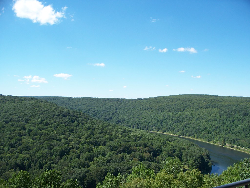
I brought with me on this trip several guidebooks about scenic places in the state, and while my clothes were in the washer and dryer I searched for spots in the Oil City area. We discussed riding the Sandy Creek Trail again, and so I got into my riding gear.  Before we went to the trail, however, we made a trip to Kennerdell Overlook. The sky was clear, and so we had a spectacular view of the Allegheny River. I saw there seemed to be a hiking trail near the overlook, but we left that for another day.


One of my guidebooks mentioned a waterfall, Freedom Falls, with a short and easy hike from the road. Assuming we would be able to easily find the small road it was on, we postponed the planned ride till later that afternoon. Finding the falls turned out to be a challenge involving a lot of driving around on back roads. Once we found the parking area we experienced a harder than advertised hike to the falls. The distance was short, but the hillside steeper than we expected. Judy was OK but I had a little trouble, for I was dressed for riding as I hiked, wearing full kit and Crocs.

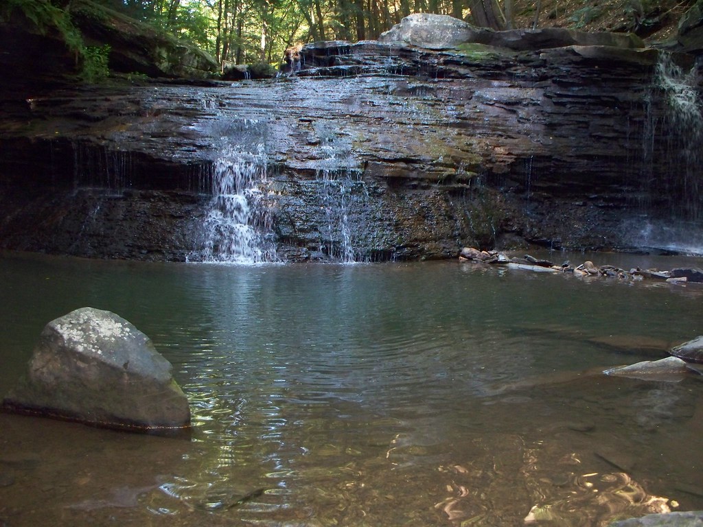
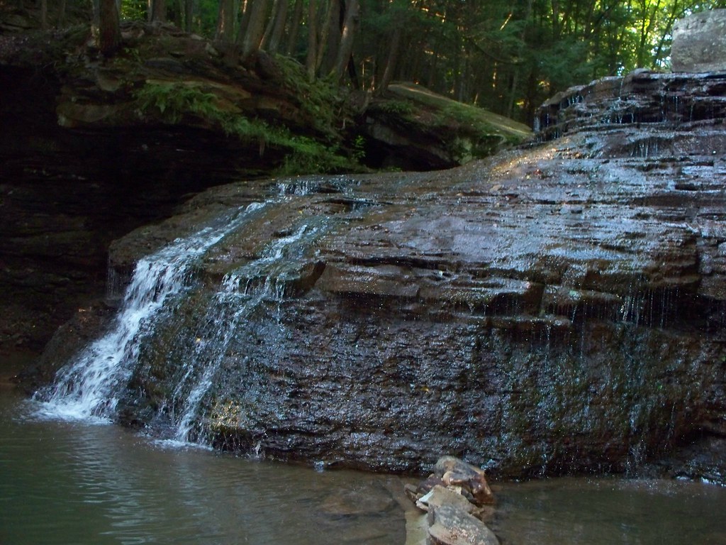
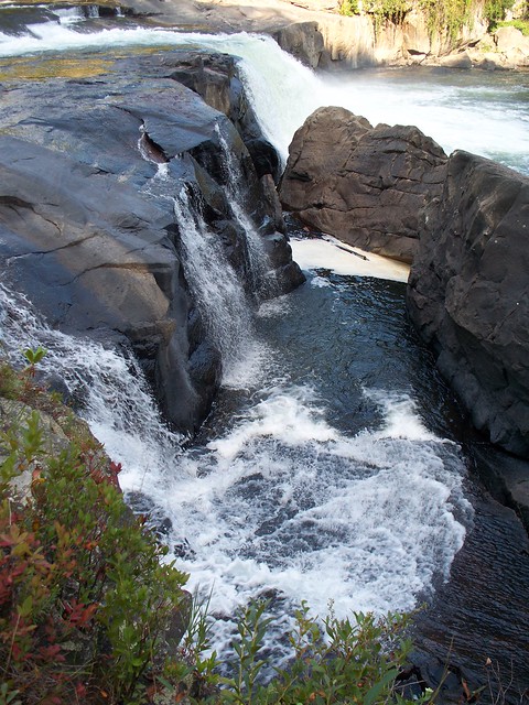
Once we reached the falls, we found it was worth the trip. Freedom Falls is big, standing over twenty feet tall and fifty feet wide. Even in the middle of an August dry spell it was impressive. The water flow in Shull Run was low enough that I could stand safely near the lip of the falls and shoot down into the plunge pool. Talk about not having a net!


Once I'd taken photos from the top, it was time to see the face of the falls. I returned to the bank of the run and made my way down to the plunge pool. I hesitated at first, but then went in.  The water level was below my knees, and refreshingly cool. Crocs were the perfect wading shoe, and I'd have not gone into the water had I been wearing hiking boots.


Photography is a fascinating subject, but I'm not a skilled photographer, nor do I have anything beyond a point and shoot.  But I do try to practice the good advice I've been given or read. One of my favorite guidebook writers is Scott Brown, author of Pennsylvania Waterfalls. Brown advised when shooting to use a lower shutter speed and a tripod, and to try to use a filter to reduce background highlighting. The woods were showing up as very bright, and since the falls as a whole weren't heavily flowing I focused on segments of the waterfall. This let me make the water the focus and allowed me to 'crop' out the woods. I won't call my photos professional or serious, but they pleased me very much. And they still do. Seeing them again reminds me of a cool afternoon along and in Shull Run.


Not quite as cool was the climb uphill. I suppose I could get a decent footing in Crocs, but my pair are a size larger than my hiking boots, and my wet feet shifted in them as I climbed. I must have looked ridiculous to anyone who saw me; a fat, knock-needed guy in bib shorts, jersey, and orange Crocs climbing up a hill on hands and knees.


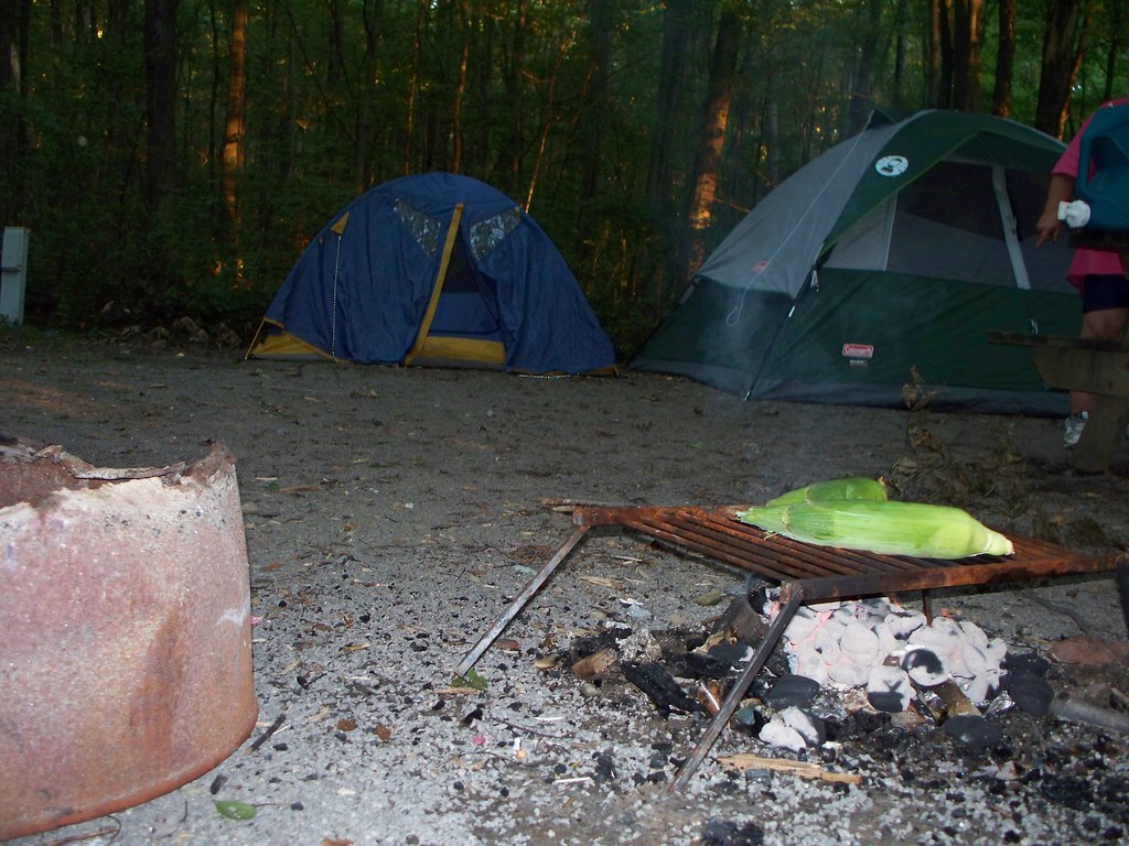
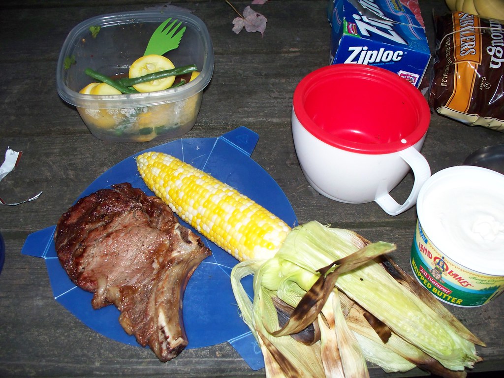
We spent an hour and a half hiking and shooting at the falls, and for an off day I'd worked up quite a hunger. Having gotten in an adventure, we decided Sandy Creek could wait for another day, so we headed back to our campsite at Two Mile Run County Park. I'd offered to make dinner, but on discovering that my campfire specialty was tuna hash, my companion decided she would cook. That evening Judy showed off her skills at camp cookery with steak, corn on the cob, fresh beans and squash, and tea, prepared over the fire pit an on her stoves. It capped an exciting and active "off day" for the two of us.


Labels: , , , ,

Tuesday, June 25, 2013

West Penn Trail, August 2010


In August 2010 I and my friend Judy took part in a group ride on the West Penn Trail. The WPT is a 17 mile patchwork of trail segments along the Conemaugh and Kiski Rivers between the towns of Blairsville and  Saltsburg. Having just visited Johnstown the day before, I was curious to see where the Conemaugh went to, so we met up with the group on a warm afternoon at the Newport Road trailhead west of Blairsville. The sun had come out after a rainy morning, and the ride promised to be good. 

The ride was led by three rangers from the nearby Allegheny Portage Railroad National Historic Site and the Johnstown Flood National Memorial. The dozen or so riders traveled 4.5 miles to the end of the Conemaugh River Lake segment of the trail, ending at the now-closed railroad tunnel.  Our guides stopped at each bridge and the tunnel to allow the group to catch up and to talk about the history of the river and the railroad. At the turn around it was everyone at their own pace, but still most of the group stuck together. 

The tunnel is an impressive structure, but to prevent flooding of the Conemaugh Dam area on the other side of the mountain the tunnel is sealed at one end. For safety's sake the Blairsville side of the tunnel is blocked off. The trail continues as a steep mountain bike/hiking trail for two miles as it crosses the mountain. 
During our ride on the flat, gravel covered trail, we crossed four stone arch bridges built by the Pennsylvania Railroad a century ago. One can't get a good look at the bridges when riding across them, but there's an overlook, partly overgrown, you can ride to for a view of one of the spans. The bridges have a gravel trail surface because, as a guide said, "gravel is easy to replace after a flood." Despite the dam and other flood controls in place, the Conemaugh is still a flood prone river, as any resident of Johnstown can tell you. Seeing the lazy river at a low level, I found it hard to believe the water occasional laps the surface of the bridge. 

I had a great time on the ride, although I had one regret. This guy seemed to be a regular rider on the trail, and I overheard him say how he's improving his health and losing weight using cycling as exercise. He also spoke about the various species of birds he'd seen along the trail. I regret I wasn't bold enough to introduce myself and strike up a conversation with him. As a fellow fat guy, albeit a guy a lot less fat and a lot healthier, I like to meet other people on their trip of self-improvement. Also, he was the only other hefty guy sporting Lycra, so we had that in common as well. Its been nearly three years since the ride, and I hope this guy saw success in his weight loss and lifestyle improvement.

The West Penn Trail was a lot of fun, and I hope to be riding it again soon.

Labels: , ,

Monday, June 24, 2013

The Wild Side: Fern Cliff Peninsula, Ohiopyle State Park, August 2010

This is one of the most photographed waterfalls in Pennsylvania. 

But its shot from the 'wrong' side. You can see the observation platforms in the photo. Obviously I should have been on the other side of the cataracts with the thousands of other visitors.  That's the side of the river with the boat launches, and the visitor center, and the pizza place, and market..... In other words, the Ohiopyle State Park everyone visits. But just across the bridge, accessed from a parking lot or the Great Allegheny Passage trail, is a wild side to Ohiopyle. The Fern Cliff Peninsula is the Ohiopyle no one visits, and in many ways its the best part of the park. A stick of land jutting out into and partly surrounded by the Youghiogheny River, the peninsula has one of the best short hikes in the state. When I hiked it on a late afternoon in August 2010, I saw only one other person during the slightly more than two miles that passed under my boots. 

The trail I hiked was less rocky than most of the trails in Penn's Woodlands. The rockiest portion was near the falls. To get the photos above and below I had to walk out onto the rocks at the edge of the cascade. The river flow was lower than normal due to the drought conditions; I'd hate to imagine what the river and falls would look like in spring after the snow melt. 


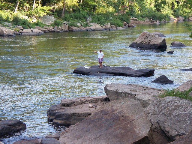
Just downriver of the falls, I saw the only other man on the peninsula. Well, he wasn't quite ON the peninsula. But I'm guessing he had to swim  or wade over to his fishing perch from the peninsula side, if only because the distance was shorter. Not that I'd swim within 200 feet of the falls, or swim with a fishing pole. Or for that matter swim in my underwear. Then again, its Westsylvania. Things are different here. 

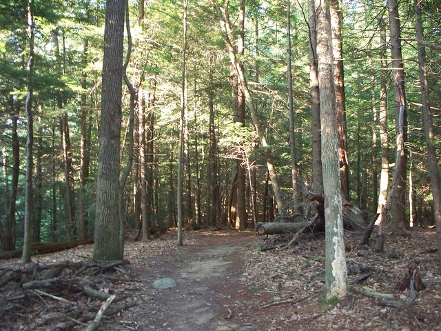
As you get further away from the falls, the trail takes you through a forest of pine and hardwood. But you are never very far from the water. The sound of the river crashes around you as you walk, following it as it drops 90 feet rounding the peninsula. It drowns out the tread of your boots on pine needles and dead leaves.  As I walked through the woods, I thanked the men and women who saved the peninsula, and the whole of Ohiopyle State Park, from becoming a vacation resort decades ago. As I finished my hike, I kicked myself for having visited Ohiopyle three times before and never once taking a walk on the wild side. I know it won't me my last time at Fern Cliff Peninsula. 


Labels: , , , ,

Saturday, June 15, 2013

Hike up Mount Tom, August 2010

Little needs to be said about my hike up Mount Tom. But there's much I want to say.

I first saw this mountain when riding the Pine Creek Rail Trail in 2009. Mount Tom is at the head of the canyon, standing out as one rides the trail or drives along Route 6. The view below is from the little church in Ansonia.

I decided then and there, astride my bike, that I'd hike up that mountain one day. Part of it was just knowing it was there. Part of it was that I had a friend I'd met on a bicycle message board I was posting to, a fellow using the screen name "Tom Stormcrowe", who like me had overcome physical limitations. Climbing Mount Tom was obvious but potent symbolism and a tribute to my friend. After my first round of treatment on my knees in 2010, I made plans to spend a few days in Pine Creek Gorge and hiking Mount Tom was a priority.


I picked up a guidebook from Pine Creek Outfitters that contained a description of the trail to the overlook atop the mountain. After reading the description and speaking with the staff at the outfitter I decided I was going to hike the longer but easier way to the top, following the old logging road. The shorter way required some scrambling and bushwacking I didn't feel I was physically capable of. Another day, perhaps.

The morning of the hike was hot for the gorge, and the air was sticky. My having camped for two nights without a shower didn't help my mood either. Nor did my initially parking at Darling Run and not finding the trailhead there. Frustrated, I put my car on the wide shoulder of the road and searched for the logging road gate.


Once I found it, I headed up. And up. The climb wasn't hard, but it was long. The road had been overgrown with grass, and I was glad I'd applied Off! to my legs and boots. I was covered with the repellent, and the two spots I missed - my shoulders - were soon covered with flies. They'd probably not smelled anything like me in a long time.


The climb continued. I trudged on. After a couple of miles the trail began to flatten and the tree cover become thinner. I passed through an area that had been logged within the past couple of years. I spotted the blue blazes and knew I was close to the overlook.

And before I expected it, I was there. The overlook is getting overgrown, unfortunately, but the view of Route 6 and Ansonia is still pretty impressive.


Once at the top, I had lunch, walked around at the top of the mountain, and caught up with my phone calls. (There is no cell phone service through most of the Pine Creek Gorge, and outside the city of Wellsboro the signal is weak at best. But I had a full set of bars on the mountain top.) I placed a call to Tom Stormcrowe explaining what I'd done and where I was calling from. He seemed nearly as pleased as I was.


I put my new tripod to good use and posed for a couple of victory photos. Looking back at this hike if I regret one thing its that haircut. Right idea, wrong execution. Short hair is great when rough camping. Near-shaved head? Not a good look and prone to sunburn.


Getting down the mountain wasn't hard, but again, it was long. I felt very stiff at the end of the five mile hike. But an hour and a meal in the air conditioned comfort of Pag-Omar Farmers' Market refreshed me, and I ended my day with a ten mile ride on the Pine Creek Rail Trail.

Mount Tom isn't big or high, even by Pennsylvania standards.Nor is it a difficult hike. But hiking to the top made me feel good in a way I hadn't in a long time. When I met my friend Judy for a ride on the rail trail in September 2012 I pointed towards Mount Tom. "See that mountain?" I said. "I hiked up it." I was smiling as much at that moment as I was when I reached the top in 2010. Just like I'm smiling now writing about it. 

Labels: ,

A Taste For The Woods

This page has moved to a new address.

A Taste For The Woods