Friday, October 25, 2013

Icebreak Trail, Tioga State Forest, PA, October 2013

One reason I love the Pine Creek Gorge area is that the hiking is less rocky. Not easier, and not rock-free, but less like climbing and more like walking. So was the Icebreak Trail, a short mile in the Tioga State Forest to the rim of the gorge.

Aside from crossing downed trees, which included straddling them a couple of times, and watching for the dreaded "root snakes" most of the hike was uneventful. The path to the overlook was through a sea of dead and dying ferns, and sea after sea of them. As for the vista at the end of the trail, it was worth the walk despite the overcast, drizzly weather. The Icebreak Vista is also on the West Rim Trail, and its little more than a mile from Bradley Wales Vista. Had I not hurt my back in my fall on the Tanbark Trail in the Catskills a couple of days before, I'd have hiked a 4 some mile loop on the Icebreak, West Rim, and the forest road that connected the two. Perhaps when I'm next in the gorge and the weather is better I'll do just that.

Labels: ,

Lamb's Creek Trail, Mansfield, PA, October 2013

While on vacation and fighting for survival in a world with the US government running at 85 per cent of normal, I came across the Lamb's Creek Trail. The trail and surrounding recreation area are run by the US Army Corp of Engineers as part of the Tioga Lake and Hammond Lake dams. I expected the recreation areas would be closed and under armed guard to keep people from using the trail, but it was open and unattended as usual. The Outflow Campground on the Great Allegheny Passage, also run by USACE, was closed, so I expected Lamb's Creek to be as well.

The Manfield end of the trail is just outside the center of town, behind a closed Sears Hardware store. "Probably ransacked by the locals to arm themselves for surviving the Great Shutdown" I thought. There were no bathrooms to change in, however, so I drove to the end at the boat launch in the recreation area. I gunned the motor of the car to smash through barricades, but there none. I parked, changed, and took off the bike. I didn't see any sign of a Mad-Max style end of civilization in Mansfield, so I didn't put traps around the car. Instead I just headed out for a ride, as if the world were working as it always did.

The trail is about three and a half miles long, flat, paved, but in poor repair in spots. I had to swerve around rough pavement often. "Already the Great Shutdown has had an impact," I thought. One oddity of the trail is that there is a lunch-heaving climb over a small dam just outside Mansfield. To add to my ride I continued on to the boat launch on Lamb's Creek, bringing my mileage to eight for the day.

Aside from the rough pavement and the dam, the riding was easy. I had a good time on the Lamb's Creek Trail while surviving Shutmageddon.


Labels: ,

Lake Minnewaska, NY, October 2013

As I'd written previously, the last day of my New York adventures featured two hikes with the Caleb's Crew Hiking Club of Freehold, NJ. Earlier in the day we'd hiked Sam's Point, and to finish we put in three miles on the carriage roads around Lake Minnewaska. 

Lake Minnewaska State Preserve is a large holding in the Shawangunk Mountains and was long-known for being a tourist attraction. During the days of the "400 families", the well-to-do would take the train from New York City to New Paltz and then be transported to natural wonders like the spring-fed Lake Minnewaska. The preserve has an extensive network of the old gravel roads the carriages used to haul the Vanderbilts and their friends around. One such road traveled three quarters of the way around Lake Minnewaska, and we used it for our hike. 

While the road was gravel and wide, it wasn't flat. The walk was broadly rolling, with climbs and descents that worked me but didn't stress me. As at Sam's Point, this slow walker at times was leading the group. 

The final climb was to our lunch stop, the picnic area high atop the white sandstone cliffs. The air was cool, the sun was out, the company was good, and the late afternoon light ideal for photography. In the photo with the picnic table you can see the Catskill Mountains in the distance. 

The Crew put in about three miles that afternoon. I look standoffish in the photo on the cliff, but that's nerves from standing so close to the edge. I seemed to fit in well with the group, and as circumstances permit I'll join them on hikes in the future.

And Lake Minnewaska is going to be in my future. There are other trails and roads to build up to - a waterfall, the rock outcropping known as "Gertrude's Nose", and more await my next visit.


Labels: , ,

Thursday, October 24, 2013

Pole Steeple, Michaux State Forest, May 2010

My first hike up Pole Steeple was in 2010, three months after I'd had my right knee lock. In between I'd had treatment with Euflexxa, a synthetic joint fluid, and a diagnosis that knee replacement was in my future at some point. I was cautious about what I could do, but determined to be active. I'd been sedentary most of my life, and I was too young to go back.

Somewhere I'd read or heard about Pole Steeple, the rock outcropping overlooking Pine Grove Furnace State Park. It might have been when I camped there in 2009. It might have been online, or in one of the many hiking guidebooks I'd consulted. But I'd come across it, read it was only a mile up, and longed to hike it. So on Memorial Day I arrived to join a group hike up the mountain. Our guide was a Pennsylvania Department of Conservation and Natural Resources Park Ranger; our group soon enough consisted of the two of us, the other hikers going at a faster pace.

The climb was tough for me, and I had to stop at a couple of places. I picked through some of the rougher spots. Soon enough I was on the switchback to the top. We chose the back way to approach the overlook, instead of the direct assault with the rock scramble.

And after coming through the trees we were on top. This was a big moment for me. I'd hiked before, but never so high. Nor had I ever reached such a place before on my own two legs. And the view! No wonder I held my poles in the air, looking as a friend said "like the god of lightning summoning the elements."

But for all my bravado, I didn't venture very far onto the rock outcroppings. I wasn't as brave as these young women, for instance, sitting on the edge of the cliff over a 75 foot drop to the trail below. The second after I took this photo, the woman on the left screamed. She claimed she felt the rock move under her. I doubt it moved, but still, her scream made me nervous to be any further out on the rock.

The sky began to darken as we stood on the overlook. The ranger knew what was coming, and we turned around and headed back down the mountain, as the faster hikers fled past us.

We passed around the back of the overlook as the rain came down. And it wasn't a gentle rain, but buckets. Streams formed on the switchback as we slowly made our way down. The ranger could have hiked out in no time, but he stuck with me as I picked my way down. As we transitioned from the switchback to the main trail I thought "I hope that's the worst of it."

Then the hail started.

The ranger tried to keep me engaged in conversation as we made our way down the slope. Had someone been listening, they might have found the conversation surreal.

"How much water did you get in your boots?"

"Too much," I said. "My socks are soaked. And these boots are nearing the end of their life." I stopped to clear water off my glasses.

"I got these at a sporting goods store, and waterproofed the heck out of 'em. You should try that before your next hike. Its an easy and cheap upgrade. By the way the slope over here is a little easier."

Meanwhile hail is falling and water is gushing down the trail deep enough to reach my boot laces.

Eventually we reached the trailhead, just as the hail stopped. In the rain I turned to the soggy ranger and thanked him for helping me up and down Pole Steeple. It was his job, but he didn't have to be as nice as he was while doing. it. His calm on the descent helped me stay focused despite the weather. As he got in his truck he said to me "you might think of yourself as a beginning hiker, but today you took everything the mountain could throw at you and came through." And he drove off to the park office and a dry uniform.

In the trailhead parking lot a couple waited out the rain. I asked them to take my picture. Sopping wet, cold, water squishing from my boots, I wasn't going to be denied my victory photo. After all, I'd taken everything Pole Steeple could throw at me and come through.


Labels: ,

Tuesday, October 22, 2013

From Mesopotamia to Peninsula - Ohio and Erie Canal Towpath, July 2011 and July 2013

During my Ohio adventures of 2011 and 2013 I did some rides on the Ohio and Erie Canal Towpath in and around Akron. I'll present them stitched together as one ride, starting south of the city and heading north to Peninsula, and written as a guide rather than an account of my experiences.

The official guidebook for the canal towpath called the area to the south of Akron "Mesopotamia" because it's between bodies of water. But it's also fairly barren, with no services until the Portage Lakes area. The scenery along the canal is pretty but the towpath itself is exposed, so don't expect shade.


The trail becomes paved as you enter Akron, rubber capital of the world and crystal meth capital of Ohio. When the towpath trail reaches Summit Lake, tribute is paid to the canal builders. Faced with a swampy body of water to cross, the canal built a wooden, floating towpath for the mules. So the present day trail crosses the lake surrounded by water. Its an impressive view, and there are observation areas along the floating trail. I spent several minutes here one afternoon soaking in the scenery.


The trail rises from the river as it enters downtown Akron. At the time I rode it the north and south sections of the towpath hadn't been connected. I understand the missing link is now in place. In 2011 I had to got up some nosebleed climbs onto city streets. The detour wasn't well marked. I got lost a couple of times, but I eventually found the towpath again. The trail is an urban park as it passes through the downtown, and at times the detour used sidewalks.

The name Akron comes from the Greek words meaning "high place", which explains the trail bridge leading out of the downtown and down a 5 per cent grade for a mile. The reason for the 5 per cent grade is the steep ascent the canal had to make. You get an idea of what the canal builders faced just north of the downtown in the area called "Cascade Locks." The canal needed 15 locks in little more than a mile to get boats up and down from Summit Lake. Once past this area, you are back on gravel and amid nature, following the Cuyahoga.

On my 2011 trip I hung out a few minutes at the small park at the bottom of the 5 per cent grade. This park celebrates the flour and oat mills that Akron was famous for in the 19th century.

Heading north, the trail follows the river. The scenery is wooded, aside from a brief stretch snaking through a suburb of Akron.  I tried to see things off the towpath as well, for the trail has a lot of connecting paths, for walking and riding, that are worth taking. There's a small heron nesting site a few hundred feet off the trail at Bath Road. One trip I rode partway up the mile climb to the Hale Farm, a 19th century 'living museum.' The climb was too much, so I turned around and stopped at Indigo Lake for a couple of minutes.

A highlight on the trail is the beaver marsh. The mammals helped reclaim an old auto dumping area, and the towpath, like at Summit Lake, floats over the marsh. There's a observation area with seating, and on various trips I've seen turtles, fish, heron, and yes, a beaver. On a future trip I'd love to get here at dawn, simply to experience the place at daybreak.

If you feel thirsty or hungry as you approach Peninsula, there is a nice farmer's market that provides fluid and fuel on a hot day. Its only a block from the trail, but be careful, as its busy with cars and bikes coming in and out of the lot.

Riverview Road is flat for much of its length, and it makes a nice change of pace from the towpath if you've done the trail more than once. Drivers seemed to respect bikes even though the shoulders are narrow. Just past the farmer's market is a road leading to the Everett Covered Bridge. The short trail bans bikes, but I didn't realize it. I dismounted when I saw the horses and no trouble was caused. Anyway, its a short walk from the connecting road.

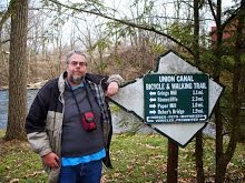
Turning around here on Riverview Road might be a good idea. While its rideable into Peninsula, the climbs are tough. Better to take the flat and scenic towpath, passing by, and sometimes through, canal locks. Soon enough you are in Peninsula. Take some time to see the small town, the locks, the river, the train, Century Cycles, and the main eatery in town, the Winking Lizard.


Mention of the Winking Lizard reminds me of my rides with my friend Aaron. We explored the towpath together, riding from Akron to Cleveland in segments, and our rides always ended with a trip to the Lizard. Those were among the happiest days I've spent on a bike. Aaron also rode with me on the brutal day to Mosquito Lake State Park, and he was coughing up blood the next morning. If our friendship can survive that, I think it can survive anything.

When I was very down after my knee replacement, my weight was ballooning and my activity level was at zero. When other 'friends' were abandoning me, Aaron told me "I believe in you" and stuck with me. So my memories of the towpath are always happy ones, knowing that my buddy was there.... and was there for me when I needed him. I hope everyone who reads this blog has such a friend.

Labels: , , ,

Allaire State Park, NJ, October 2013

This past Saturday I met my friend Allen at Alliare State Park near Freehold, NJ, for a hike. Allaire is a park like many in Pennsylvania, built around the remnants of the early days of the industrial era. James P. Allaire was a mechanic and inventor, and made his fortune in iron, establishing an iron works at the site of the present-day park.


Aside from the preserved furnace stack, many of the buildings from the town around the iron works are intact, and this historic village is a highlight of the park. I enjoyed the hike with Allen, one of the few people who matches my walking pace, but the Halloween decorating of the buildings struck me as both tacky and out of period. I don't doubt that the original residents would have decorated for All Hallow's Eve, but they'd not have put a giant inflatable rat on the roof either.


The two of us put in about a mile and a half of walking through the town and on a couple of nearby trails. After a stop at the visitor's center, housed in row-homes built by Allaire for his workers, we took the Pine Creek Railroad ride through the park. The Pine Creek Railroad is run by the New Jersey Transportation Museum, and is a simple mile loop through the park. Yes, its short, but what boy doesn't love a train? I'd missed my chance to ride a scenic railroad in Cuyahoga Valley National Park earlier this year, and the Pine Creek Railroad made up for it in a small way.

Labels: , ,

Viking Ship, Marsh Creek State Park, Downingtown, PA, October 2013

A Viking ship is a rare sight on a Pennsylvania lake, so when I learned the Norseman was sailing October 13 I made sure I was there.

Leif Ericson Day is October 9, and to mark the annual celebration of the explorer now credited with stumbling on North America before Columbus, the Philadelphia-based Leif Ericson Viking Ship folks took their Norseman out on the lake at Marsh Creek State Park. The ship was scheduled to land at noon at the West Boat Launch area. I arrived at 11:40 and began firing away with the camera. 
Conditions were less than optimal for the Norseman. While it was a warm fall day with beautiful skies, the wind was strong, and the ship was rowed to shore rather than under sail. The crew was in good spirits. I noted that they were a mix of reenactors and enthusiasts. While that seems a strange distinction, I don't know how else to describe that some people were in costume and some weren't, and that some of the costumed folks made concessions to modern life; I doubt any of Ericson's crew wore Nikes, for instance. 
After landing, the crew and their support on land held a ceremony in honor of Ericson's landing. Each year a different Scandinavian country is recognized as part of the ceremony. This year the honor fell to Norway, and the Norwegian national anthem was sung, followed by the Star Spangled Banner. The leader of the group read a short speech about Ericson, and the annual statement from the White House about Leif Ericson Day. The crowd of thirty people enjoyed the short ceremony, which ended with a wreath-laying on the dock and the blowing of a ram's horn. 

But for me the day continued. I spent some time photographing the ship up close, and then went on a short hike along the lake. I put about a mile under my boots, enjoying the crisp air and the views of the lake. It was a good time, and now I know for certain the Vikings were in Downingtown before Columbus. 


Labels:

Monday, October 21, 2013

Red Glare, Price, Maryland, April 2013

In April of this year I went with my friend Chris to Red Glare, a rocketry event on Maryland's Eastern Shore. My idea was that I'd spend some time riding on the flat, low-traffic roads of the area and observe Chris' hobby. I've written about the ride, and now I should give some photos from Red Glare itself. 

My background is in a hobby, chess, filled with odd people, and I had expectations I'd find rocketry to be the same. Or, in other words, I expected to find my friend Chris the norm rather than the exception. I was wrong. While the geek levels soared as I approached the launching area, everyone remained pleasant and talkative, and they had a good sense of humor about their obsession. (A high school rocketry club wore tee shirts saying "Yes, I AM a rocket scientist.")
Another surprise was how large some of these rockets were. I should have remembered the Apollo missions and the massive Saturn V rocket used to launch the capsule into orbit. Even these smaller payloads sometimes required a large rocket to boost them into the air. Note this man resting the nose of the rocket on his boot. I saw several people doing that, and it struck me as odd until I realized they probably wanted to keep dirt from getting onto the nose. NAR isn't NASA, but rocketeers take launching as seriously, and they don't want extra weight to cause a problem at launch. 

I wrote of oddity before, and Chris lived up to his reputation this trip. However, for all his eccentricity of dress and manner, on the whole he's a remarkably helpful and polite man. Witness the lesson on rocketry photography he gave to a man and his son on the launch field. And Chris' good nature remained unimpaired during the seven hours he spent standing on the launch field photographing rockets. My good nature, if any, would not have fared so well in such circumstances.


Speaking of not doing well, the gentleman in the previous photo did not have a successful recovery of his rocket. While the rockets have parachutes that should open when their fuel is spent, not all do, and not all get off the pad successfully. Nor do they always follow their flight path. This rocket had a hard landing in the corn field behind the spectators. Its owner had built the rocket for his Level 1 certification flight - the hobby's managing group has certification levels for flying motors of different sizes - and he was now reduced to taking apart the wreckage of his 200 dollar investment looking for parts to salvage. He remained in good spirits, partly disappointed but also pleased that he'd had a launch and that he was on the right path to success. He would find what went wrong and not have it happen next time. I was reminded of the old quip about Edison learning ten thousand ways to not create a light bulb.


Thanks to Chris' instruction, my rocketry photography improved throughout the day. But whereas Chris and the other rocket photographers focused on the mechanics, I focused on the interactions of rockets and people. Machines like bikes and rockets and what not are interesting products of man, but Man himself is more fearfully and wonderfully made than any contrivance. So while Chris' photos show launch after launch, my photos are different. Chris was pleased I photographed the launch of this "drag race" (rocketry slang for multiple rockets launching at once) but what makes the photo for me is the crowd. Its not a perspective Chris could get shooting where he did, but its the perspective I like best.

While I had a good time in my two days at Red Glare, I doubt I'd go again unless it was to ride the Eastern Shore. A little rocketry goes a long way for me. That's not a knock on rocketry. I just fly on different motors than the rocketry folks do... and I like my flight path.

Labels: ,

A Taste For The Woods: 2013-10-20

This page has moved to a new address.

A Taste For The Woods