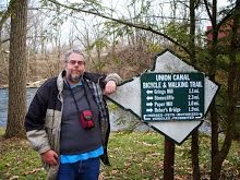
Wednesday, January 8, 2014

Hills Creek State Park, Wellsboro, PA, October 2013

I came to use the bathroom. I stayed to hike. That's how I met Hills Creek State Park.

I'd arrived in PA very late after a six hour drive from the Catskills, and spent the night sleeping in the back of the car at a Wal-Mart parking lot. I'd hurt my back two days before in a fall on a hiking trail. I was grubby, sore, cranky, and tired. And when sore, cranky, and tired I hate being grubby. So after visiting an overlook on 15 South and finding the restrooms not suitable for giving myself a 'birdbath, I searched the map for the nearest state park.

Hills Creek State Park sits on 407 acres of land and water, astride Hills Creek and containing the lake created by damming. The lake features boating and swimming at your own risk, and had I brought my swimsuit with me I might have gone into the cold water. Instead I located the bathhouse, found it open, and made myself more presentable and comfortable. On this October day I had the place to myself.

Now feeling better and in a better mood, I hiked. I was still tired, and so my determination and stamina were nowhere to be found. I stuck with a ramble along the lakeshore. I hike a mile, perhaps more, but I don't know the total, and don't care. The day was overcast, but not gloomy, cool but not cold. Fall was around me, and it was fall in Tioga County, my favorite spot in the state, and perhaps the world. John Donne wrote "In heaven its always autumn", and even though he never visited the banks of Hills Creek I can't help but think this day is what Donne had in mind.


 After the hike I sat on a bench and had lunch, staring out at the lake, wishing I could be here forever. Unfortunately I knew I had to find a place to stay that night, and my plans didn't include camping at Hills Creek. So I headed back to the car, refreshed in body and spirit. I'd been searching for a place to refresh, and in more than one way I'd found just that.

Labels: ,

Sunday, January 5, 2014

Pine Hill Bridge, Ulster County, NY, October 2013

Near the Town of Shandaken in New York is the Pine Hill Bridge.  Unlike most of the covered bridges I've visited, Pine Hill is new construction, having been built in 1992. The bridge spans Birch Creek outside the Bellayre Mountain Day Use Area, and is just off New York Route 28. When I visited the bridge, and the day use area, was closed, but walking around the barricade wasn't difficult. I did keep my visit short as a precaution. The best view of the bridge is from the Day Use Area side, so I parked near the entrance on the roadside and walked across.

For more information on this beautiful span, visit http://www.coveredbridgesite.com/ny/pine_hill.html . I agree with the writer at that website that the bridge looks best from this side but it looks great any time of year, not just winter. And in fall the Catskills run riot with color.... how can you resist shooting then?


Labels: ,

Saturday, December 28, 2013

Overlooked Overlooks, Tioga County, PA, October 2013


I had a rough start to my trip back to PA from the Catskills. I left Phonecia at 6 PM and headed west towards Pine Creek Gorge. What looked short on paper was six hours of driving, and I arrived at Mansfield after midnight. I chose the path of least resistance and 'camped' in the back of my car in the parking lot of the local Wal-Mart. After getting a few hours of restless sleep I headed back up Route 15 to the visitor's center. I'd seen a sign for "overlook" on the drive into Pennsylvania and I knew the visitor's center was on the southbound side of the road. So a quick turnaround at the Tioga exist had me heading south again and in a minute I was pulling into the parking lot.

I arrived before the local fog had burnt off, so I spent time in the visitor's center picking up maps and travel brochures. When the fog cleared I was treated to an expansive panorama of the Tioga and Hammond Lakes dam area. There are a couple of platforms for viewing, but you can photograph anywhere along the fence, and the fence is long. Both the photographs to the right were taken at differing locations on the fence. Walking along it was the easiest "hike" I'd ever done, and one of the most rewarding.

I wasn't done with Hammond and Tioga Lakes, however. Later that day I'd come across a map showing an overlook just off Route 287 North, opposite the lake. I drove to Ridge Road, went round a hairpin turn under a rock cliff, and passed a long-abandoned and chained pulloff. I parked the car, went around the barrier - using a stick to probe the high grass for timber rattlers - and spent a few minutes contemplating the beauty of Tioga County. Tioga is my favorite region of Pennsylvania, and its views like this that remind me why. A day that started with grubby sleep on a bad back in a parking lot ended with this. All days should improve like this.

Labels: ,

Tuesday, November 26, 2013

Bushnell Falls, Shandaken, NY, October 2013


This is a "hike" of 100 yards or so, but I thought I'd mention it. Bushnell Falls is on Route 42 North from the town of Shandaken. Five miles northbound there is a pulloff to the left. (Scott Brown's book on New York waterfalls has an error and puts the parking area on the other side of the road.) A walk on a short trail brings you to the falls. The day I visited it was a trickle down the side of Halcott Mountain, but after a rain or in spring it will be a more impressive cascade.

As the weather was dry and the flow minimal, I ventured onto the falls itself. Of course my fear of heights kicked in as I tried to leave and it took me ten minutes to get off of a ledge that it took ten seconds to get onto. Sometimes its really, really tough to be me. But discovering Bushnell Falls, a piece of beauty I'd have driven past when I sedentary, makes up for the occasional problems.

Labels: , ,

Catskills Scenic Trail, October 2013

I try not to dwell on the negative in my outdoor writing. But the day I fell on the Tanbark Trail in the Catskills was one of the worst I've had outside. And it was capped by the Catskill Scenic Trail.

After I'd gotten off the Tanbark Trail, I headed back to the cabin. I was already in a bad mood, full of self-loathing. Lunch didn't change that. But I felt a good bike ride, like the one I'd had the day before on the Walkway Over The Hudson, would change my mood. So I dressed in riding gear, loaded the bike onto the rack, and set off to the only rail trail in the Catskills. 

I should have checked the mileage beforehand. I was over an hour from the trail. But having set my mind to it, I drove and drove. I finally reached the town of Bloomville.... and drove past the trailhead. It wasn't my fault, for the trailhead wasn't signed. When I parked, the only other vehicle was an abandoned car. 

I ignored the omens and started off. The trail's website mentions several crossings of the Delaware River - yes, THAT Delaware River - and I was looking forward to taking photos. But shortly past the trailhead the surface of the trail became a mass of potholes and ruts. I am not a strong rider, but I've ridden canal towpaths and gravel trails since 2007, and this was the worst surface I've come across. Then I discovered why the trail was so bad. The trail runs through farm land, and farm equipment used the trail. I turned around, and in a foul mood rode back to the car. I drove on to the next trailhead, in the town of Stamford, and after searching for it located the old trail station.

In Stamford the trail was in better condition, or so I thought. I rode a couple of miles towards Bloomsville, but even here there were problems. I felt odd bumps under my wheels. Apparently when they turned the old rail line into a trail they didn't bother to remove the ties. I was riding over the railroad ties sticking up through the gravel. I turned around and rode back to the station. Heading in the other direction was the final straw for me, as I soon came across a trail 'repair' that consisted of dumping a bunch of loose gravel. I packed up the bike and drove back to the cabin. 

Some people might say I came to the trail with a bad attitude. Perhaps. But even if I were in a good mood I'd be annoyed at a trail ruined by farm equipment and neglect. Anyway I finished the day with three miles and a bad mood even the glories of the Catskills in fall couldn't cure.


Labels: ,

Wednesday, November 20, 2013

New York State of Mind - Hudson Valley Rail Trail and Walkway Over The Hudson, October 2013

I was down. My planned trip to Florida to visit my friend Sayre was scrapped for various reasons, and I was tentatively planning a "staycation."

However, my mood changed when a friend suggested I stay at a cabin they had purchased in the Catskill Mountains. I was surprised to discover the drive was no longer than the five hours I'd take to get to Pine Creek Gorge, for instance, and so I set about making plans. I've been to New York City twice as an adult, but aside from staying overnight at a friend's home in Buffalo I'd never been to New York State. I overplanned as usual and much of what I hoped to do was rewritten on the fly, but I got in the best experience largely as planned - the Walkway Over The Hudson.

The Walkway Over The Hudson is a lineal park, or what we ordinary folks might call a "trail", utilizing an old railroad trestle spanning the Hudson between Highland and Poughkeepsie. The bridge is one and a quarter miles long and the longest elevated pedestrian span in the world. Bikes are allowed on the bridge, and cyclists can avoid the day use fee the park charges by parking at trailheads on the adjoining trails in Highland or Dutchess County.

I arrived in early afternoon at Tony Williams Park on the end of the Hudson Valley Rail Trail, four miles from the west end of the bridge. The Hudson Valley Rail Trail is a paved path running at a mild grade down to the bridge. On a fall Wednesday afternoon the trail was busy. I changed into riding gear at Tony Williams Park's bathrooms and headed out.


The colors of fall were around me. I took the tree colors on the trail as a sign of what I'd face in the Catskills. I felt like I was flying down the trail, passing the small road crossings and under a culvert. Before I expected it, I was at the bridge and riding the Walkway Over The Hudson.


The bridge itself is wide, and while it was full of pedestrians and pets and cyclists 'traffic' was orderly and there were no near-misses or evasive actions that I could see. The view up and down the Hudson was spectacular, as was the elevated view of the city of Poughkeepsie. For people who want to stop and take in the view there are benches on both sides of the span. And should you tire of the Hudson the bridge is a great place for people-watching. The Walkway when I visited was used by all sorts of folks - commuters on foot and on bikes, people out for a stroll, roadies riding a loop .... and a formerly sedentary man from Pennsylvania rediscovering the outdoors.

I crossed into Dutchess County and began to ride on their extensive trail network. However, time demanded I turn around after a couple of miles. I still had to drive an hour into the Catskills and locate my friend's cabin, and I was advised to get there before dark lest I have trouble locating it. So I headed back to Highland and my car. My dozen miles on the trails and Walkway was the highlight of my trip, and I long to ride them again. And more importantly, I was no longer down. I was, indeed, idle no more.


Labels: ,

Wednesday, October 30, 2013

Overlooks in the Catskills, October 2013

Overlooks and vistas in the Catskills aren't like the ones I've experienced in other states. The roads and towns in the Catskills are located in the valleys, so getting a view from the top takes a bit of work. The three shortest hikes to overlooks I could find were the mile-long Tanbark Trail, four miles for the Giant Ledges, and six miles for the top of Slide Mountain, highest in the range. After my fall on the Tanbark I decided to leave the others for another day. So most of my vistas were from the valleys, and consisting of pull offs on the road.

One of the better ones was Palmer Hill, past Arkville on Route 28, the main east-west highway in the central Catskills. It had some rise, and there were several nice angles for photos.


The pulloffs on Route 28 I found to be boring, but one on Route 30 a few miles from the intersection of the highways was promising. However, I arrived late in the day and the light wasn't very good. When I am next in the area I'll have to visit again.


Side roads were hit and miss, and I didn't want to spend hours driving up and down mountains on gravel looking for vistas that might not be there. However, I did find two while headed elsewhere.

This photo was taken from the car. There was no pull off, but the road was quiet, and so I rolled down the driver's window and fired away. I was above the town of Fleishmann's - I don't remember the road.


Much of the Catskills is private land, and I generally respect property rights. However, while driving around I glimpsed a vista through a strip of trees. I parked the car, walked through an opening in the stone fence, and saw this. The owner hadn't posted "No Trespassing" anywhere I could see, and he had cut a short trail through the meadow. I took it, and took 50 photos from various angles. Because its private land I won't disclose where it is. Whoever the owner is, thank you.


Labels: , ,

Friday, October 25, 2013

Icebreak Trail, Tioga State Forest, PA, October 2013

One reason I love the Pine Creek Gorge area is that the hiking is less rocky. Not easier, and not rock-free, but less like climbing and more like walking. So was the Icebreak Trail, a short mile in the Tioga State Forest to the rim of the gorge.

Aside from crossing downed trees, which included straddling them a couple of times, and watching for the dreaded "root snakes" most of the hike was uneventful. The path to the overlook was through a sea of dead and dying ferns, and sea after sea of them. As for the vista at the end of the trail, it was worth the walk despite the overcast, drizzly weather. The Icebreak Vista is also on the West Rim Trail, and its little more than a mile from Bradley Wales Vista. Had I not hurt my back in my fall on the Tanbark Trail in the Catskills a couple of days before, I'd have hiked a 4 some mile loop on the Icebreak, West Rim, and the forest road that connected the two. Perhaps when I'm next in the gorge and the weather is better I'll do just that.

Labels: ,

Lamb's Creek Trail, Mansfield, PA, October 2013

While on vacation and fighting for survival in a world with the US government running at 85 per cent of normal, I came across the Lamb's Creek Trail. The trail and surrounding recreation area are run by the US Army Corp of Engineers as part of the Tioga Lake and Hammond Lake dams. I expected the recreation areas would be closed and under armed guard to keep people from using the trail, but it was open and unattended as usual. The Outflow Campground on the Great Allegheny Passage, also run by USACE, was closed, so I expected Lamb's Creek to be as well.

The Manfield end of the trail is just outside the center of town, behind a closed Sears Hardware store. "Probably ransacked by the locals to arm themselves for surviving the Great Shutdown" I thought. There were no bathrooms to change in, however, so I drove to the end at the boat launch in the recreation area. I gunned the motor of the car to smash through barricades, but there none. I parked, changed, and took off the bike. I didn't see any sign of a Mad-Max style end of civilization in Mansfield, so I didn't put traps around the car. Instead I just headed out for a ride, as if the world were working as it always did.

The trail is about three and a half miles long, flat, paved, but in poor repair in spots. I had to swerve around rough pavement often. "Already the Great Shutdown has had an impact," I thought. One oddity of the trail is that there is a lunch-heaving climb over a small dam just outside Mansfield. To add to my ride I continued on to the boat launch on Lamb's Creek, bringing my mileage to eight for the day.

Aside from the rough pavement and the dam, the riding was easy. I had a good time on the Lamb's Creek Trail while surviving Shutmageddon.


Labels: ,

Lake Minnewaska, NY, October 2013

As I'd written previously, the last day of my New York adventures featured two hikes with the Caleb's Crew Hiking Club of Freehold, NJ. Earlier in the day we'd hiked Sam's Point, and to finish we put in three miles on the carriage roads around Lake Minnewaska. 

Lake Minnewaska State Preserve is a large holding in the Shawangunk Mountains and was long-known for being a tourist attraction. During the days of the "400 families", the well-to-do would take the train from New York City to New Paltz and then be transported to natural wonders like the spring-fed Lake Minnewaska. The preserve has an extensive network of the old gravel roads the carriages used to haul the Vanderbilts and their friends around. One such road traveled three quarters of the way around Lake Minnewaska, and we used it for our hike. 

While the road was gravel and wide, it wasn't flat. The walk was broadly rolling, with climbs and descents that worked me but didn't stress me. As at Sam's Point, this slow walker at times was leading the group. 

The final climb was to our lunch stop, the picnic area high atop the white sandstone cliffs. The air was cool, the sun was out, the company was good, and the late afternoon light ideal for photography. In the photo with the picnic table you can see the Catskill Mountains in the distance. 

The Crew put in about three miles that afternoon. I look standoffish in the photo on the cliff, but that's nerves from standing so close to the edge. I seemed to fit in well with the group, and as circumstances permit I'll join them on hikes in the future.

And Lake Minnewaska is going to be in my future. There are other trails and roads to build up to - a waterfall, the rock outcropping known as "Gertrude's Nose", and more await my next visit.


Labels: , ,

Friday, October 18, 2013

Notch Lake, Stony Clove Notch, Phoenicia, NY, October 2013

Sometimes being outside isn't exercise of the body, but of the soul. My last experience on the Catskill trip was visiting Stony Clove Notch. I was tipped off to it by a passing reference in Scott Brown's book on New York waterfalls. Brown mentioned shooting photos at the lake was a good alternative to the waterfall hike he outlined, and he gave suggestions on how to frame the photo. While I never saw the lilypads he suggested focusing on, I found my own way. Mr. Brown and many other people are better photographers than I am, but the photo below gives me great pleasure.

Stony Clove Notch is a few miles north of the Town of Phoenicia on NY Route 214. The notch is a passage between the mountains Hunter and Plateau. At the foot of Hunter is Notch Lake, and on the edge of Notch Lake is a day use area and long-term parking lot for backpackers. A popular hiking trail, the Devil's Path, crosses the day use area.

Aside from one person asking for directions - his accent placed him as from the Bronx, so he was very lost indeed - I was alone. I lingered as the sky grew dark and the mist began to form. I hated to leave. I'd not climbed a mountain in the Catskills. I wanted to. I wanted to be atop Hunter or Slide or Halcott or... but it wasn't going to happen this trip. I'd fallen once, and I was bent like a question mark thanks to twisting my back the wrong way.

I delayed leaving as long as I could. But I had miles to travel before I slept, so I said "till we meet again" to Hunter and Plateau, and started the long drive to Pennsylvania and Pine Creek Gorge.

Labels: ,

Diamond Notch Trail, Lanesville, NY, October 2013

After my bad experiences hiking on the Tanbark Trail and riding on the Catskill Scenic Rail Trail, I wanted SOMETHING in the Catskills to go right. I knew I wasn't up to the challenge of the hikes to the Giant Ledges or to the top of Slide. Wanting to salvage something of the trip, I found what has been called the easiest hike in the Catskills - Diamond Notch Falls. It wasn't a peak, but it might be what I needed.

Diamond Notch Trail is an old forest road allowed to fall into trail use. The trailhead is a small pull off at the entrance to the trail on Greene County Route 6. The road dead ends at the trail, and so its only accessible by car from Route 42. The drive north from Shankaden, alongside Halcott Mountain, is scenic, and after a few miles you turn right onto County 6. After another seven miles the road becomes gravel and reaches the trail. I've put Lanesville in the subject line of the post only to give a landmark; don't expect anything resembling a town here.


The trail surface itself becomes a mix of small and medium sized stones and dirt. While it wasn't like hiking in Rocksylvania, I did have to employ more caution than I expected. The trail climbed on the left side of the West Kill, and I was delighted by the continuous series of cascades. Scott Brown in his book on New York waterfalls wrote that if you have all day and don't mind getting wet and bruised you should skip the trail and hike in the creek, and perhaps he is right. The stream is always below the trail and it involves a scramble to get to it. Hiking on the streambed would let you get many photos of the petite cascades.

After a mile I came to Diamond Notch Falls proper, a fifteen foot drop that was unfortunately a fraction of its spring runoff glory. However, the bridge that appeared in both guidebooks I consulted was gone. If I wanted to see the falls up close I either needed to enter the creek or approach from the other side, and without the bridge that meant scrambling down a twenty foot slope. I'd be nervous about doing so even if I hadn't been alone or had a stiff back from the fall the previous day. So I turned around, thwarted by the Catskills yet again. That said, it WAS  a pleasant two mile hike to the falls and back, and one day New York may replace the bridge.


Labels: ,

Sam's Point Preserve, NY, October 2013

My trip to New York State and Pine Creek Gorge was largely a disappointment. I fell on the Tanbark Trail, I drove for an hour to the Catskill Scenic Rail Trail and found it a mess, my hurt back limited what I could do in both the Catskills and the Endless Mountains, and finally heavy rain forced me home early. And then.....

Chris, my friend in New Jersey who led me up to the Raven's Horn in August, contacted me with a suggestion. His church's hiking group was leaving for a day on easy trails in the Shawangunk Mountains in New York the next morning. Was I free? Yes, I was. And the night sleeping in my own bed seemed to have taken much of the trouble out of my back. So at 8:30 AM I was in New Jersey ready to join the trip north.


This was my first hike with a large group in years, and it was a good experience. Caleb's Crew Hiking Club is a group based on the membership of Chris' church, of which he is pastor. The name of the group comes from the Book of Joshua in the Hebrew Bible. After years of faithful service to God, Caleb is still ready for more work. Caleb asks God, as the King James translators put it, "Now therefore give me this mountain...." 


Our "mountain" today would be relatively easy. Sam's Point Preserve was a hike of a little more than a half mile to the top and the overlooks. And it used "carriage roads" - the improved forest roads the "400" leading families of New York City used when they vacationed in this area. So while the hike was a climb, it was relatively easy. The six tenths of a mile to the top sped by. And speaking of speeding, for once in my life I was near to leading a parade. I'm used to being the slowest walker or hiker or cyclist, and I was leading at times. I slowed as we passed the side of the rock outcropping we would soon stand on top of. 


The first overlook at Sam's Point is two thirds of the way to the top. Already the view was spectacular - forest everywhere, and in the far distance to the north the edge of the Catskill Mountains. The ledges were enormously wide compared to the Raven's Horn and Pole Steeple in PA. And the view only improved as we climbed to the top. Again it was a climb, but not an arduous one. Either I am improving or the carriage road was no challenge to me.

The main overlook at Sam's Point has a low stone wall around the platform, but visitors aren't restricted to that area, and there are other attractions one can hike to - a waterfall and a series of caves, for instance. But we restricted ourselves to the overlook and nearby rock cliffs. The latter pushed my fear of heights hard, but I won, as you can see in the photo of my walking along the cliff edge. That portion of the cliffs is accessible from a trail through the forest of dwarf pine, which is but another attraction among many here. This first hike in the Shawangunks gave me what I'd been looking for, and couldn't find, in the Catskills.


After we came down from the mountain we had lunch and headed off to our second hike of of the day, Lake Minnewaska, which I'll cover in another post.

Labels: , ,

Thursday, October 17, 2013

Tanbark Trail, Phoenicia, New York, October 2013

I was full of enthusiasm for my first hike in the Catskills. It was a sunny day, the temperature was cool, and I was surrounded by mountains higher than those in Pennsylvania. I had batteries, a working camera, and a good attitude. I'd hiked up Hawk Mountain, Pole Steeple, and the Raven's Horn. How much trouble can this be?

Phoenicia, pumpkin spice soy latte capital of New York.
I'd chosen the Tanbark Trail based on a description in a brochure on hiking published by Ulster County. It had an overlook, was less than a mile long, and wasn't too far of a drive. And the brochure didn't describe the trail as difficult or technical.

I set off in high spirits. The trailhead is in the town of Phoenicia, which could be described as the Portland of the Catskills if Portland were five blocks long. I parked in front of the post office, laced up my shoes, grabbed my hiking poles, and headed off. First I crossed a small park, then over a wooden bridge at the entrance to the trail.

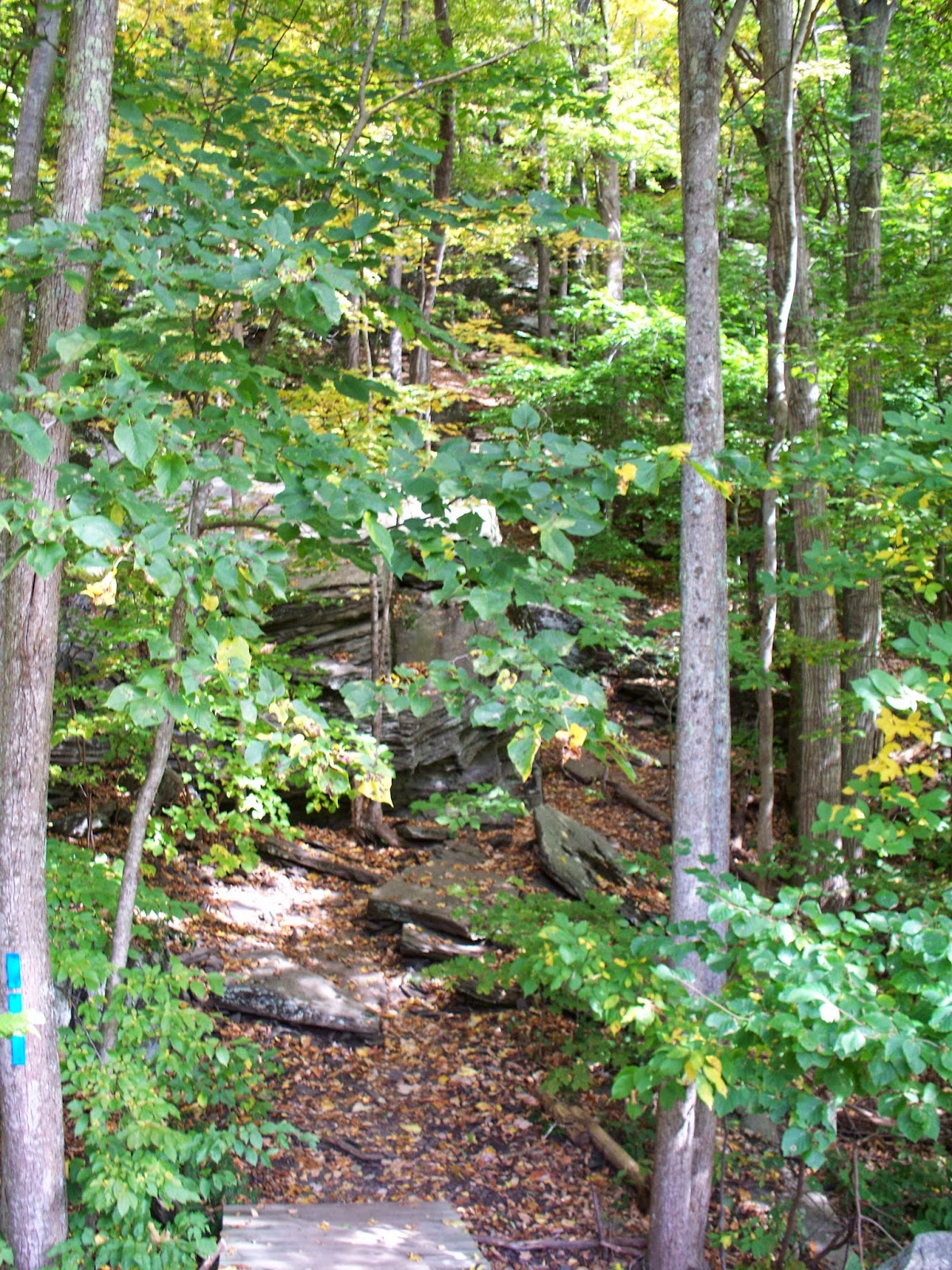
And then I saw the wall. The Tanbark climbs Mount Tremper, and it might as well have been a brick wall. It was all I could do to get my footing. It was plant one foot, plant both poles, bring the other foot up, check for timber rattlers, repeat. I am a slow hiker under normal circumstances, and as tough as the Raven's Horn was, this was tougher. And unlike the PA trail I didn't have two experienced hikers with me.

I got around the rock outcropping in the photo, and proceeded on to the next part of the climb. My shoes dug into the earth and I planted my poles. I reminded myself that I can do all things through Christ who strengthens me and I pushed on.

About now I became concerned about getting down. One of the members of the Caleb's Crew Hiking Club recently advised me that I needed to take "the next step" - that I'm a "big idea" person, that I like to see projects as a whole from beginning to end, and that the next step is to have faith - not just in God but in my abilities to complete a task. Finding the trail more difficult than I imagined, I doubted myself. And I doubted how to climb up the trail. Since the going was tough and the slope steep, I tried lowering myself to the ground and proceeding on all fours.

Pants by Cabela's, shoes by Brooks, socks by Wigwam.
My changed stance was a poor decision, and lasted only a few steps. By now I was so discouraged and full of doubt I decided to turn around and call it a day. The Tanbark could wait. I tried to back down the slope. I slipped, began to slide, and in the scramble to regain my footing wound up on my back and backside. My heels dug into the crumbling earth. I looked down, and decided crashing into the tree or the large rock beneath me would have been unpleasant. So I sat on the side of Mount Tremper while I caught my breath. While calming down I took a couple of photos and marveled at how tough my outdoor clothing is.

I'm estimating I was perched there for ten minutes, but it could have been less. I didn't cry for help because while its bad enough to abandon a hike a tenth of a mile into it, its worse to need help getting off the hike. While usually pride goes before a fall, in this case it came after.

Eventually three hikers wandered by above me. I called out to them.

"Good morning!"

"Good morning!"

"I was wondering if you might give me a hand here."

"What's the problem? Are you OK?"

"Oh, I'm OK, but I can't get up."

The lead hiker, Matt, hastened down the slope with the two ladies in his group. Matt and an older Russian woman took charge. They helped me slide down to the rock, stand up, and guided me back down the hill. Despite my seeming calm, I was nervous and embarrassed about the hike, and talked too much, I'm sure. But we got down safely, and Matt and the Russian woman - I never learned her name - posed for a photo with me. In the photo I look very short, but that's because they stood on the footbridge to the trail and I didn't.

I thanked my 'trail angels' and headed back to the car. Matt and the Russian woman were alternately full of encouragement and chiding - I deserved praise for pushing myself and hiking trails that would challenge me, and it was a poor choice to do such a difficult trail, and to attempt it alone.

At the time I was discouraged and down about the 'failed' hike, but looking back at a distance of two weeks gives me a different perspective. The comment made to me about the next step - having faith - seems to be key here. I knew I could hike the trail based on my experiences with others. But I doubted myself. I need to work on that, take the next step, and remain confident that I can do it. Self confidence is a bigger mountain to climb than Tremper, and I have no doubt that if I return to the Tanbark Trail I will be at the overlooks - standing up.


Labels: ,

A Taste For The Woods

This page has moved to a new address.

A Taste For The Woods